The ridge is
17 km long as the crow flies and could be done as a day's walk with cars
at either end.
However there are several great day's walking shown here and using these
walks you can do the whole range in easily manageable
stages over a period of time. Doing this also gives you the opportunity
to discover some of the interesting features in the adjoining territory
- particulaly to the east of the Rhinns - the old
mine workings at Garryhorn, the "Black
Watch" figurehead at Forrest Lodge, the memorial
to the young shepherd lost in a snow storm below Millfire, etc.
This is a ridge with spectacular views, particularly
to the west over the the Silver
Flowe and the Dungeon
Hills to the Awful Hand.
The view to the east beyond the valley of the Water of Deuch is of the
Scaur
and Carsphairn Hills and though perhaps not quite so dramatic these
hills still very much have their own charm.
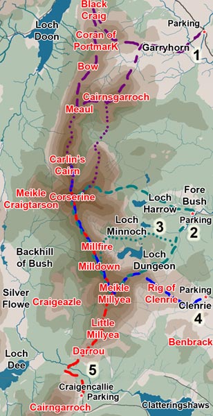
For a general picture of the whole area see the
Galloway Hills Map.
Parking grid references are:
Green Well of Scotland - on the A713 road near Garryhorn - NX557943
Forebush/Forrest Lodge - NX552863
Clenrie - NX558824
Craigencallie - NX504782
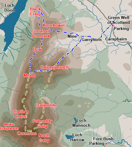
The map on the right is taken from the web gallery of route 1 as shown in the map at the top of the page. There is a layby just across the road from Green Well of Scotland. The blue route is the one described in that gallery, but the green route is probably the more spectacular taking in as it does both Carlin's Cairn and Corserine, each of which are higher than 800 metres.
If you want to do the whole of Rhinns of Kells in separate easily manageable
stages, as suggested above, then you would combine these two routes as
separates day's walks with the others shown on this page.
Like the many old deserted houses you find scattered about the hills the
old mine workings at Garryhorn set you speculating on what life went on
here.
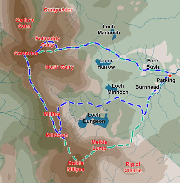
To the left is the map taken from route 3
from the map at the top of the page here in blue. The route for route
2
in is also shown here in green.
They both start from the car park between Forrest Lodge and Fore Bush
There is an information board
at the car park telling you of the three separate ways through the forest
to get onto the Rhinns that you can take from there. These 3 ways correspond
with what you see in this map.
Route 2 (in green) heads north of Loch Harrow up onto Corserine then heads
south east to Meikle Millyea and back through the most southerly way through
the forest.
The rig of Clenrie itself is a really awkward rough moorland route that I don't particularly like, though the views of Meikle Millyea as you approach Meikle Lump are spectacular.
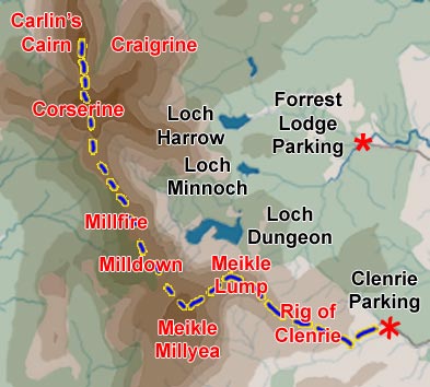
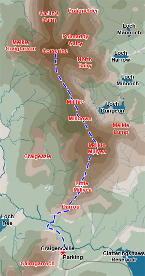
The map on the left is taken from the web gallery of route 5
as shown in the map at the top of the page.
Craigencallie is the nearest public access to the southern end of the
Rhinns of Galloway. You pick up the road into Craigencallie
just west of the dam at the southern end of Clatteringshaws
Reservoir. You drive along this narrow road until you come to a locked
gate across the road just past Craigencallie Outdoor Centre (NX504783).
There is a car park there for
several vehicles. From there you go over the gate and head along the
forest road in the direction of Loch Dee until after about 1km you come
to another forest road branching off to the right. As you turn into this
road you will see a quarry low on the side of the hill opposite you. Make
for the quarry, then head up through it and through the firebreak on the
hill leading from it and you are now beginning to climb Darrou.
In the early stages of this walk, as you climb towards Meikle Millyea,
there are excellent views across Loch Dee to the Minnigaff
Hills. From Little Millyea onwards you start to get excellent views
across the Silver Flowe and the Dungeon
Hills to the Awful Hand to
the north west of you and this view will develop constantly as you head
for Corserine. It is this view that makes walks along the Rhinns of Kells
so special.