Maps
of Merrick and Dungeon Hills Routes with Summaries for Each Route
Site Homepage
- Other Galloway
Walks - Large map of Galloway
with routes
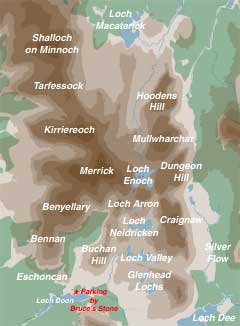
Some of the other maps on this page date from the early days of this website but they offer some background to the walks.
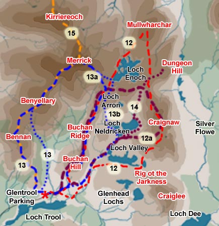
In the route along the entire Awful Hand (number 15 in the top map) you start and end at quite different places. This means using 2 cars. It is the only route that we have yet done this on in the South West of Scotland (we had planned a day to do the whole of the Rhinns of Kells in one session and got a group organised to do this, but on the day the weather was disgusting). For the Awful Hand we dropped one car at Glentrool and took the 2nd one up to an old quarry some two and a half kilometers short of Stinchar Bridge on the road up from Glentrool.
Mouseover the map to see the route we took. To go to the page describing a walk along the Awful Hand click here.
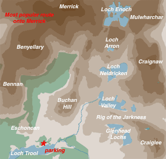
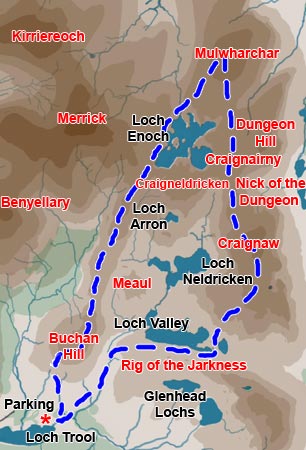
| The map on the right shows
the route which is most commonly taken up the Merrick - the "tourist
route" (number 13
in the top map - blue spots section to Merrick). It is a linear route
- you come back down the same way as you went up. It is signposted
at the car park by Bruce's Stone. There is on this site a web gallery
called the Tourist Route
which goes up over Bennan and back the tourist route - the full route
13. Because it is the highest hill in the South of Scotland the tourist route is one of the most heavily used and eroded paths in the area. On a summer's day you could well find a couple of dozen folk at the top of Merrick or somewhere along the route, often dressed in totally unsuitable gear, but enjoying the challenge nevertheless. That is busy by the way by Galloway standards. |
 |
| Mouseover the map above to see the route. | |
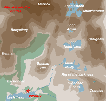 |
This route, Merrick via the Lochs (number 13b in the top map) is also quite popular. When you leave the parking place at Bruce's Stone you follow the road down to the Loch and head eastward towards Glenhead. After a short distance you will see a sign directing you to the left for the lochs. Follow this track round the side of Buchan Hill and thence up the Gairland Burn. This section along the burn is usually pretty wet and muddy, even in the summer. From Loch Enoch you take the Redstone Rig up onto Merrick and from Merrick you follow the popular Benyellary route back down.
|
Mouseover
Map on the left to see the route. |
|
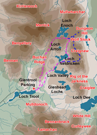
| For this route, Merrick
via Buchan Ridge (Number 13a
in the top map) you again head down towards Loch Trool but as soon
as you cross the bridge over the Buchan Burn you should enter the
gate on your left, by the spectacular lightning-blasted tree. Of course circular routes can be done either clockwise or anti-clockwise. Although this route is shown as heading up Buchan Hill first you could just as well head up Merrick first and if you are likely to be coming back into the sunset then clockwise might be the best since you can get spectacular sunsets along the Buchan Hill ridge with it's views both east and west. Mouseover the map on the right for the route. |
 |
 |
Route 12
in the top map heads up the Gairland Burn almost as far as Loch Valley.
You cross the burn before you get to the loch and head along the Rig
of the Jarkness till you come to the east end of Loch Valley where
you drop down to the narrow strip of land between Loch Valley and
tiny Loch Norroch to the east of it. Look out for hidden holes among
the rocks as you make that descent - there is a nasty wee bit here. You push on now up onto Craignaw. Make sure you visit Dow Loch on the way - a really beautiful place - and look out for the monument to the crashed F1-11E which is just south west below the summit. There is a nice wee scramble down off Craignaw to the Devil's Bowling Green and some great views down Nick of the Dungeon to the Dungeon Lochs and the Rhinns of Kells beyond. As you go over Craignairny you start getting great views along the Awful Hand ahead of you on your left (NW). Mulwharchar is right in the heart of the Galloway Hills with 360 degreee views. From there you can go down and have a dip in Loch Enoch before heading down the Buchan Ridge. A big day's walk. |
In Route 12a
you go right on past Loch Valley to Loch Neldricken before you start
heading up onto Craignaw. There are some really spectacular erratics
as you head up here (huge boulders left by the retreating ice age). |
 |
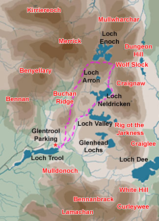 |
As you can see route 14
has much in common with route 12a. The difference is that instead
of heading up onto Craignaw from Loch Neldricken you wander along
the silver sandy beach and drop in for a dip. The water looks so
tempting but there is a lot of weed in there and although I have
been in the water I avoided swimming through the weed - for obvious
reasons. |
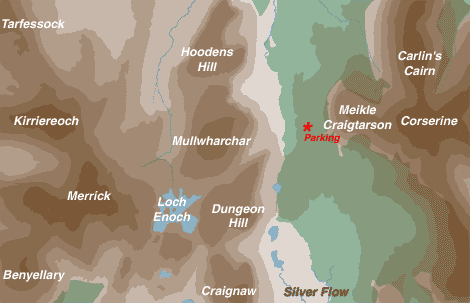
This is a rather sneaky route. though there is not a web page or gallery for it on this site. To get to the parking place you have to drive up a very rough forest road from Clatteringshaws Loch. It's Forestry Commission ground and you may find the gate closed and locked when you get back down to it at the end of the day! So if you are willing to take the chance head on up past the Backhill of Bush bothy to the foot of Meikle Craigtarson and look for the handiest fire break. Of course you could walk in and spend the night at the bothy - though I have seen better kept ones. Mouseover map on the left to see route.