|
The North End of Rhinns
of Kells from Green Well of Scotland
|
|
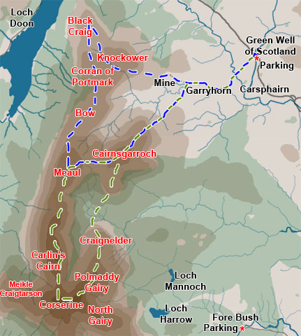
Map of a circular hill
walking route from Green Well of Scotland onto the north end of the
Rhinns of Kells going over Black Craig, Coran of Portmark, Bow, Meaul,
and Cairnsgarroch
|
|
Click on the left side
of the image to go back to the previous image and on the right side
of the images to go to the next image
|
|
| 01 The route covered in this web gallery
is the blue route - done counter-clockwise. The green route is also well
worth doing. The difficulty with both these routes is that you have a
longish walk in and back to your car from Green Well of Scotland. We have
in the past driven right up to the old disused mine but the road from
Garryhorn to the mine is very rough for a private car. We have also parked
at Garryhorn with permission of the farmer there, but again that is not
all that satisfactory - disturbing the farmer to ask for permission. So it is better to park beside the A713 (Castle Douglas to Ayr road) about one and a half kilometers north of Carsphairn village on a bend just where the road bridges the Water of Deuch (OS Ref. NS557944). For a picture of the parking place see the Cairnsmore of Carsphairn route. There are two walking routes on this site which start from Fore Bush. The pictures on this web gallery were taken on a walk we did here on the 5th July 2004. |