|
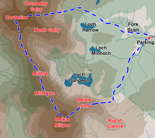
Rhinns of Kells from
Fore Bush - Corserine, Millfire, Milldown and Meikle Millyea
|
|
Map of a circular hill
walking route from Fore Bush onto the Rhinns of Kells in the Galloway
Hills taking in Corserine, Millfire, Milldown and Meikle Millyea
|
|
Click on the left side
of the image to go back to the previous image and on the right side
of the images to go to the next image
|
|
| 01 To get to the parking place shown above in the
Forrest Estate, you pick up a single track road heading off to the left
as you head north towards Ayrshire from St
John's Town of Dalry on the A713 road. There is a sign saying "Forrest
Road" just where you turn off. You then drive around 8 kilometres along this single track road before you arrive at the car park. There is plenty of parking there but there is also a bewildering number of forest tracks going in all direction from the car park. There is however an information map showing the layout of these roads which also indicates 3 walking routes from here through the forest to get onto the hills - one for going to Corserine, one for Millfire and one for Meikle Millyea. We will go out on the Corserine route and back on the Meikle Millyea one though of course you could do the route in either direction. |