|
Rhinns of Kells from
Fore Bush (2) - via Milldown, Millfire and Corserine
|
|
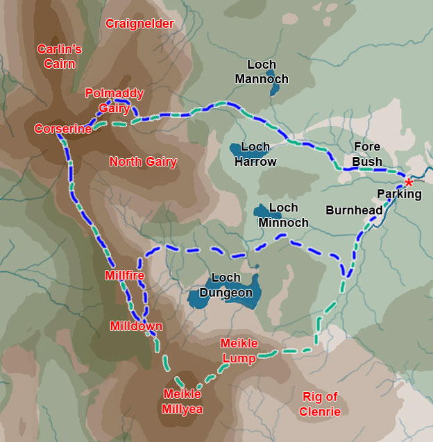
Map of a circular hill
walking route from Fore Bush onto the Rhinns of Kells in the Galloway
Hills via Milldown, Millfire and Corserine
|
|
Click on the left side
of the image to go back to the previous image and on the right side
of the images to go to the next image
|
|
| 01 The route covered in this web gallery
is the blue route in the map above. The green route was covered in Rhinns
from Forebush. I walked that route on 18th March 2009 in such thick
mist that I was never able to see (or get pictures of) the rest of the
Galloway Hills which lie to the west of the Rhinns of Kells. So I was
back on 25th March 2009 to get the pictures that are in the present web
gallery. At the parking place near Fore Bush, Forrest Estate has provided an information board with a map for hill walkers on which 3 routes onto the Rhinns are shown. On the green route above I had gone out on 18th March on their route to Corserine and came back along their route from Meikle Millyea. So in this walk today I went out on their route to Millfire and back on their Corserine route. The slight variation between the blue and green routes at Polmaddy Gairy in the map above was suggested to me by the estate manager. He reckoned it would be easier to get up onto Corserine by heading up onto Polmaddy Gairy rather than the way I had gone on 18th March - directly up onto North Gairy. This is certainly the case even if it does make the route slightly longer as you can see. This was a day of rapidly changing weather borne in on a strong northerly wind. I took six and a quarter hours to the route. |