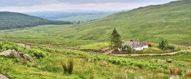
The picture below shows Clenrie house (foreground) at the bottom of the Rig of Clenrie. The car park (grid ref. NX 557 826) is just out of the picture on the left back down the track that you can see by the house. You get onto this track nearly 5 miles back down it at Glenlee (grid ref. NX 612 803) on the A762 New Galloway to Carsphairn road. The Southern Upland Way comes up the track from the car park to Clenrie but heads SSW from here (to the right in the picture) whereas we head NW up the Rig (in the opposite direction from where we are facing in this picture). For a map of routes on the Rhinns click here.
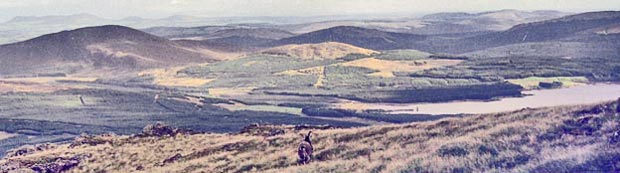
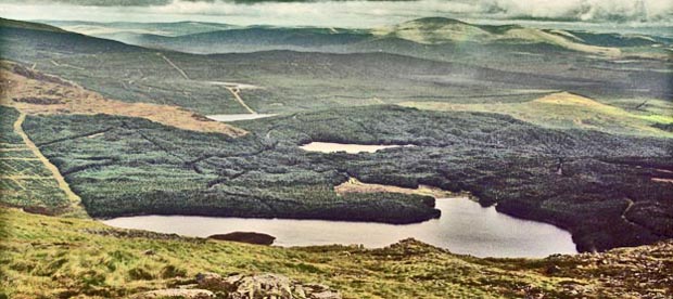
In the third picture we are near the top of Meikle Millyea looking SSE with Clatteringshaws Loch on the right and Cairnsmore of Dee on the left. Beyond, and slightly to the left of Cairnsmore is Screel and Ben Gairn which lie south of Castle Douglas. Notice the ferrel goat in the mid foreground. They are quite common in Galloway.
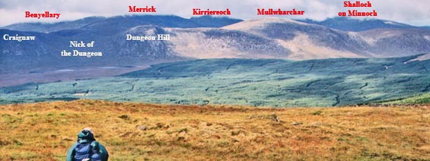
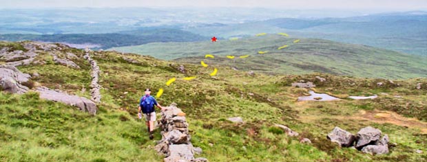
The picture above shows the view westward from Meikle Millyea as you head for Milldown. The ridge of hills comprising Craignaw, Dungeon Hill and Mullwharchar is on the Dungeon Ridge. Benyellary, Merrick, Kirriereoch and Shalloch on Minnoch, all with their tops in the mist, are on the Awful Hand Ridge. The Nick of the Dungeon is a deep cut into the Dungeon Ridge which offers a much less steep climb up onto the ridge from the Silver Flowe. You can just see the two lochs of the Dungeon below the Nick.
To see a panorama of the Awful Hand, Dungeon Hills and Minnigaff Hills click here
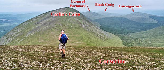
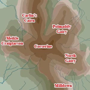
On the 3rd July 2000 when these pictures were taken we went into mist after leaving Meikle Millyea and it did not clear until we were on the top of Corserine and just thinking about heading back without seeing anything when it all opened up and there was Carlin's Cairn and the whole of the north end of the Rhinns in front of us, as in the picture above. You can see that there is a steep descent and re-ascent between the two hills - both are over 800 meters high.
Above
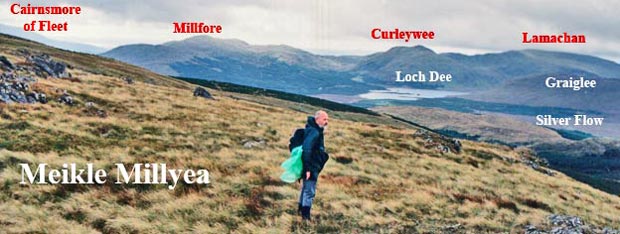
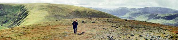
is the view back from Carlin's Cairn to Corserine with Loch Dee, Curleywee
and Lamachan right of centre. You can see from these last two picture
that Carlin's Cairn is much the shapelier of the two hills and because
it drops away more quickly all the way round the surrounding landscape
is easier to see. Corserine is a very tricky hill in mist.
With the hill being so flat and featureless on top you can very easily
get disorientated. One great shoulder runs west and two run east off the
main ridge so you have five ways off and you could easily end up going
down one of the shoulders by mistake - not necessarily dangerous, but
adding hours onto your day. See
Navigation Tips page
Here
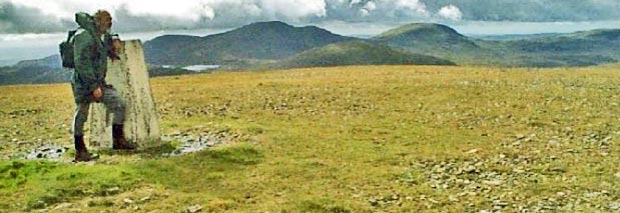
is Sandy beside the trig point on Corserine with the distinctive silhouette
of the Awful Hand behind. Benyellary is just to the right of the trig
point and Merrick is to the right of it. The solid lump of Kirriereoch
to the right of that. Again you can see how flat and featureless the top
of Corserine is.
The Loch that you see is Loch Enoch. The water that runs out of Loch Enoch,
via the Pulskaig Burn, flows into Gala Lane which in turn runs northwards
into Loch Doon. The River Doon then runs out of the north end of Loch
Doon on its way down to the Firth of Clyde near Alloway
(where the National Bard Robert Burns was born). So the water flowing
under the "Auld Brig 'O Doon" where Tam
'O Shanter's nag Maggie lost her tail to the witch Nannie originates
in Loch Enoch.