or, on the right side of it to go to the next page.
01 This walk is a sister
walk to Lowther and
Green Lowther by the Southern Upland Way. On that walk we spent much
of our day looking over to the Durisdeer Hills from the Lowthers - here
we will have the Lowthers for company as we look over from the Durisdeer
Hills. Another closely related walk to these two "sisters" is
the Dun Law web
gallery which also offers many views into these Durisdeer hills.
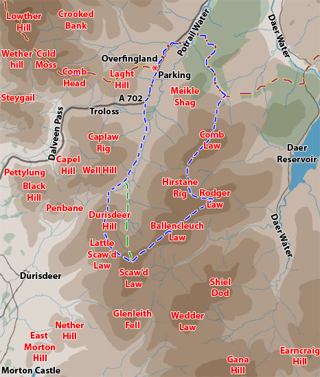
In both walks we start from Overfingland on the A702 but instead of heading
west on the SUW, here we head east. I have extended the above map as far
as Lowther Hill in the north west to link in to the Lowthers web galleries,
as far south east as Gana Hill and Earncraig to link into the Queensberry
web gallery, and far enough to the west to link into the Durisdeer
and Dalveen Pass gallery.
The purple and yellow dashes show the route of the SUW. The blue and white
dashes show today's route - though I chose on the day to head down directly
off the Scaw'd Law (green and white dashes) because I wanted pictures
in this important water catchment area which feeds the Potrail Water,
which in turn feeds the River
Clyde - the water collecting here will run through Glasgow.
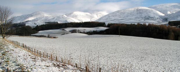
The picture below was taken as I drove up from Dumfries. The white hill
just left of centre is Penbane,
Black Hill is on the left of it and Well Hill to the right of Penbane.
The hill on the right is Durisdeer Hill and Durisdeer
village sits near the foot of Penbane where the deep valley runs out
of the hills. Here there is a Roman
fortlet and a Roman road runs up through that valley as does a medieval
pilgrimage route to Whithorn.
Later, on the latter stages of today's walk, we will be walking on that
Roman road where it emerges on the other side of these hills and heads
east up into central Scotland. In the map above you can quite clearly
see this deep cleft through the hills that the Romans exploited - running
through from Durisdeer to Overfingland.