Hill walk routes to climb in SW Scotland - also coastal paths and National Scenic Areas with maps, pictures and other useful information based on extensive local knowledge
Eschoncan, Bennan, Benyellary - returning by the Tourist Route from Merrick
Loch Enoch, the Dungeons, the Rhinns of Kells and beyond from the top of the Merrick.
Site Homepage - Galloway Home - Large Map of Galloway - List of Galloway Pages
Merrick Tourist Route Homepage
Click on the left side of the image below to go back to the previous page
or, on the right side of it to go to the next page.
View over Loch Enoch, Dungeon Hill and Craignaw  looking eastward to Meikle Millyea in the Rhinns of Kells from the top of the Merrick View over Loch Enoch, Dungeon Hill and Craignaw  looking eastward to Meikle Millyea in the Rhinns of Kells from the top of the Merrick View over Loch Enoch, Dungeon Hill and Craignaw  looking eastward to Meikle Millyea in the Rhinns of Kells from the top of the Merrick

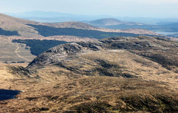
16 Swinging the camera further to the right we are now looking over Loch Enoch to Meikle Millyea at the southern end of the Rhinns of Kells. Dungeon Hill and Craignaw in the Dungeon hills lie on the far side of Loch Enoch with the Nick of the Dungeon between them.
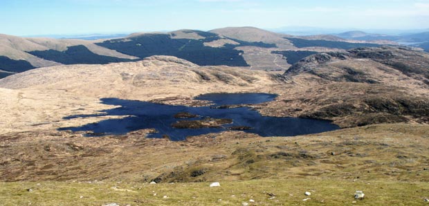
In the picture below I have zoomed in on the above picture. Mouseover to see the names of the hills. You can see Criffel near the left side of the picture. It lies some 36 miles (58Km) away from the Merrick by the River Nith south of Dumfries. Cairnsmore of Dee (just right of centre in the middle distance) lies south of Clatteringshaws Reservoir which you can also see by the right edge of the picture. Craignaw is the most rugged hill in the whole area and like many hills in this area is the site of an aircraft crash.

View of the Nick of the Dungeon, Craignaw, Little Millyea, Darrou, Cairnsmore of Dee and Criffel from the top of the Merrick
Go to Page 15
Go to Page 17