Nith Estuary National Scenic Area
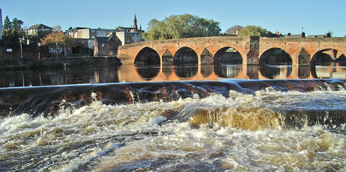
The River Nith is navigable as far as Dumfries. The modern town of Dumfries straddles the river nowadays at this point - on both banks. Formerly however, the old 'Royal Burgh of Dumfries' (created such in 1186) stood on the east bank of the river and on the west bank in Galloway was the independent town of Maxwelltown (formerly known as Bridgend) - with Devorgilla's bridge (built originally in wood in the 13th century) separating them - see picture above (in which we are looking north west). With it's 6 arches and solid piers in local red sandstone and probably dating from around 1430, Devorgilla's Bridge is the oldest surviving mutiple-arched stone bridge in Scotland. Until the early 19th century it had 3 more arches on it's east side.
There was of course much rivalry between the two towns and the justice system of Dumfries did not extend over the bridge into Galloway, so Maxwelltown was regarded as a haven for ne'er do weels and rogues. Yet one of the most infamous events in Scottish history happened in the church of the Grey Friars Dumfries in 1306 - when Robert The Bruce killed the Red Comyn on his arduously troubled route to becoming king of an independent Scotland (with ultimate success at the Battle of Bannockburn in 1314), following many years of struggle and hardship against Edward 1 and Edward 11 of England. Anyone familiar with the film "Braveheart" will have some idea of the violence and duplicity associated with Scotland's stuggle for independence through it's leaders Wallace and Bruce. This area of Scotland is steeped in that history.

Going down the west bank of the river you pass through
the village of New Abbey where you cannot fail to see the remains of Sweetheart
Abbey. Devorgilla of Galloway founded the abbey in memory of her husband
John
Baliol whose name lives on in Baliol College Oxford as it's founder.
Their son, also called John
(known as Toom Tabard), was to become King of Scotland. There is also
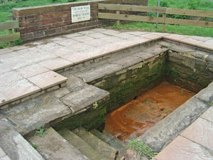
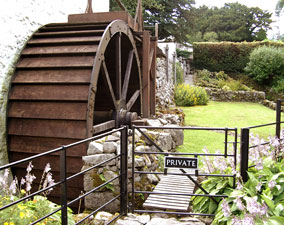
a 18th/19th century working corn
mill in New Abbey run by Historic
Scotland, (there has been a mill on the site since medieval times).
New Abbey is a bonnie wee village with a couple of pleasant pubs across
the road from each other and an excellent tearoom beside the Abbey. Beyond
New Abbey you can turn off at Kirkbean for Arbigland where the founder
of the American Navy (among various other interesting activities) was
born. He was called John
Paul Jones.
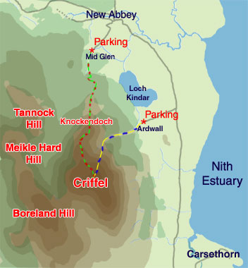
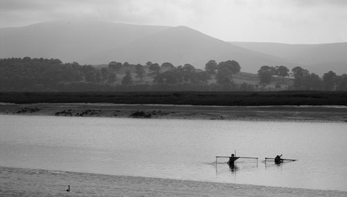
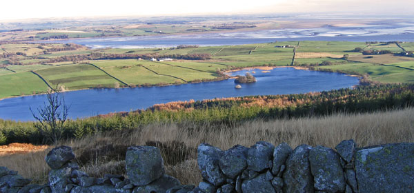
However, the place to get an overview of this National
Scenic Area (and much else besides) is from the top of Criffel or
Knockendoch as you can see below. That's Loch Kinder in the foreground
and the tiny light coloured island in the middle of it is a crannog
- an ancient settlement. The Nith Estuary lies beyond this.
In New Abbey, the narrow road up past the mill lade takes you to the parking place at Mid Glen for one of the walks up onto Criffel - over Knockendoch.
If you head another couple of miles along the road beyond New Abbey you will come to the turn off for Ardwall and the parking place for a second route up onto Criffel from there.
You can see these routes up onto Criffel on the map on the right. The route from Mid Glen to Criffel is obviously the longer of the two and takes roughly two hours to go up and back down if you are reasonably fit. It is possible to go up from Ardwall and back in an hour if you are really fit or one hour and a half if you are not. But why hurry?