The North End of Rhinns of Kells from Green Well of Scotland
A circular hill walking route from Green Well of Scotland onto the north end of the Rhinns of Kells going over Black Craig, Coran of Portmark, Bow, Meaul, and Cairnsgarroch
Site Homepage - Galloway Home - Large Map of Galloway - List of Galloway Pages
North Rhinns Homepage
Click on the left side of the image to go back to the previous image and on the right side of the images to go to the next image
View of the Dungeon Hills while heading south off Black Craig towards Coran of Portmark View of the Dungeon Hills while heading south off Black Craig towards Coran of Portmark View of the Dungeon Hills while heading south off Black Craig towards Coran of Portmark
06 As we start heading south off Black Craig towards Coran of Portmark we get this view of the Dungeon Hills to the south west. With Lamachan and Curleywee in the Minnigaff hills showing away beyond them behind the furthest away of the three Dungeon hills that you see here which is called Craignaw. Between Craignaw and the next hill, Dungeon Hill there is the deep valley of the Nick of the Dungeon. Between Dungeon Hill and Mullwharchar is another deep valley of the Pulskaig Burn. That will be Benyellary in the Awful Hand that you are seeing beyond Mullwharchar on the right edge of the picture.
Looking west in the second picture we are looking over the southern end of Loch Doon.
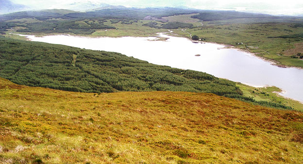
View over the southern end of Loch Doon while heading for Coran of Portmark
- Page 05
Page 07 -