| Hill walk
routes to climb in SW Scotland - also coastal paths and National Scenic
Areas with maps, pictures and other useful information based on extensive
local knowledge |
| |
| We went on this walk 11-07-99.
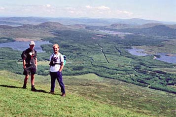
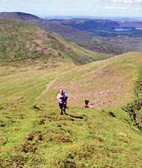
It was a really warm summer's day. We used 2 cars, one parked at Glentrool
and one up by Shalloch on Minnoch. There were four of us Mark (left) and
Stuart are in this picture. They are on the top of Shalloch on Minnoch and
I am looking north east up into Ayrshire while taking their picture. Most
of the pictures on this page have information hidden behind them - just
Mouseover to get the information. |
This
was the first walk put on this website - autumn 1999. |
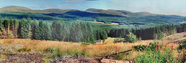
As you can see they don't
call this area Galloway Forest Park for nothing - there are plenty of trees
to the north, south, east and west. But the whole central hill area of the
Awful Hand and the Dungeon hills is clear of trees.
Between these ranges and the Rhinns of Kells is heavily forested though.
We usually try to avoid Forest like the plague and go through it only when
there is no other option. To see a map of this walk click here.
|
|
|
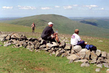
In this picture we are on the
summit of Kirriereoch. The wall the boys are sitting on is the boundary
between Dumfries and Galloway, and Ayrshire.
Dry stane dykes are a characteristic feature of the Scottish countryside
and they often come in very handy for navigation in very poor visibility
as do fence lines - both are shown on the 1:25,000 OS maps. This dyke has
seen better days. That's Jake coming towards us. |
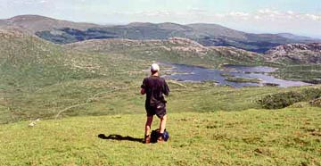
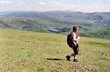
| No chance of trees or anything
much else growing in this spectacularly barren place. You can see that this
route along the Awful Hand presents very easy going sheep cropped grassy
terrain with little navigational problems, though it is quite a narrow ridge
that runs up onto Merrick from Spear of the Merrick and you need to be careful
here in icy conditions. |
|
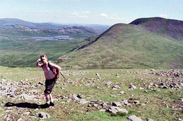
| That's Jake having a wee pose
to himself in the picture above as we head from Kirriereoch towards Merrick,
with the bare rock of the Dungeon Hills showing behind Loch Enoch. |
|
|
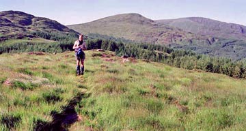
Mark in the saddle between
Kirriereoch and Merrick. You can see that the forest is planted high up
onto the Rhinns of Kells. The climb up onto Kirriereoch from Tarfessock
was quite steep and the climb onto Merrick from this saddle is also quite
steep - by comparison with the gentle rolling nature of the rest of the
route anyway. |
| The pictures below show (left)
the final ascent onto Merrick up the Spear of Merrick and then (right) Jake
beginning to make the descent from the Merrick having gone to the eastern
edge of the top for a good view down onto Loch Nelrdicken. |
|
|
| When we got to the top of
Merrick we found a dozen or so folk there - the first people we had seen
all day outwith our own group. We felt that the journey was practically
over at that stage - it would be a dawdle down over Benyellary, Bennan and
Eschoncan - but it is further than you think. Coming down off Bennan was
the most awkward terrain of the day, and then we should have come down to
the east of Eschoncan rather than straight down the front of it - steeply
down through fern which hides leg breaking boulders. Beyond the Minnigaff
Hills you can see the top of Cairnsmore of Carsphairn. There are three Cairnsmores
in the area - Fleet, Dee and Carsphairn. |
| |
Between Bennan and Eshoncan
is the only bit of forest you have to go through all day, but it is not
all that obvious where the path goes through the forest if you haven't been
there before - keep to the east. The hill behind Mark is Bennan Hill, Merrick
is on the right and Benyellary between them.
There is a fine view down onto Loch Trool from the top of Eschoncan. |
| Stuart and I went back to Shalloch
and Minnoch to get my transport, Mark and Jake walked to the pub at Glentrool.
We really did enjoy that pint when we met up with them there. It was a big
day in the sun. |
|
| The picture above shows the
Awful Hand from the west just a few miles down from where we parked at the
start of the day. The "fingers" of the Awful hand are the series
of ridges running west from the main tops - see the map
of the Galloway Hills |
| |
| |
|
|
|
|
|
|
|
|
|