Hill walk routes to climb in SW Scotland - also coastal paths and National Scenic Areas with maps, pictures and other useful information based on extensive local knowledge
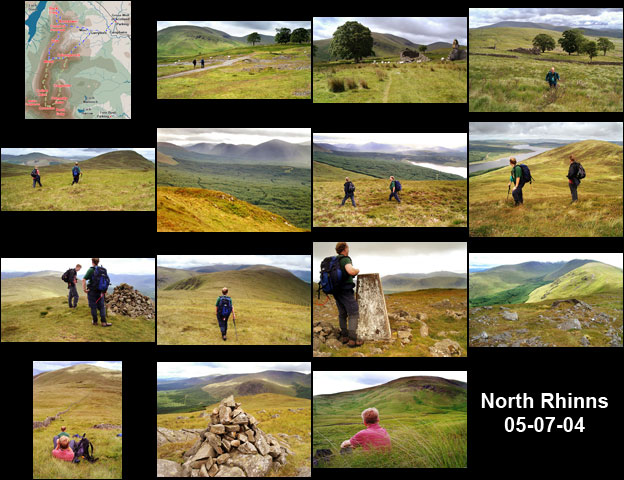
The North End of Rhinns of Kells from Green Well of Scotland
A circular hill walking route from Green Well of Scotland onto the north end of the Rhinns of Kells going over Black Craig, Coran of Portmark, Bow, Meaul, and Cairnsgarroch

Site Homepage - Galloway Home - Large Map of Galloway - List of Galloway Pages

Click on any picture to go to a larger version of it
Views from Coran of Portmark and Bow Views taken as we start climbing from the lead mines Map of a hill walking route from Green Well of Scotland onto the north end of the Rhinns of Kells going over Black Craig, Coran of Portmark, Bow, Meaul, and Cairnsgarroch Heading along the track from Garryhorn farmhouse towards the old mine buildings Views of old ruined buildings left over from the days of lead mining here Making for Black Craig and view from there over Loch Doon Views taken around the cairn on Coran of Portmark Views taken while heading south off Black Craig towards Coran of Portmark Views taken while heading into the saddle between Black Craig and Coran of Portmark Views from ascent of Coran of Portmark looking back towards Black Craig and Loch Doon Views towards the Dungeon hills and the Awful Hand from the trig point on Meaul Views from Meaul Views taken while descending from the top of Meaul towards Cairnsgarroch Views from around the top of Cairnsgarroch View looking back at Cairnsgarroch from near the old mine buildings at Garryhorn