Hill walk routes to climb in SW Scotland
- also coastal paths and National Scenic Areas with maps, pictures and
other useful information based on extensive local knowledge
Swatte Fell from Moffat Well 3
|
Hill walk routes to climb in SW Scotland
- also coastal paths and National Scenic Areas with maps, pictures and
other useful information based on extensive local knowledge
|
||
|
Swatte Fell from Moffat Well 3
|
||
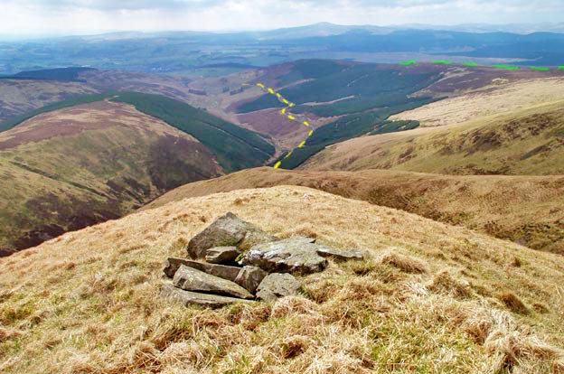
| The picture below shows the view from the top of Nether Coomb Craig. The lower part of the route can be seen in yellow along a vehicle track back to Moffat Well. Queensberry is the hill on the sky line just right of centre. The route we took up can be seen in green on the right. | ||
|
||
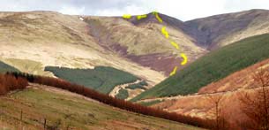
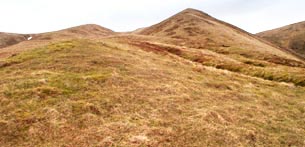
| The picture below left shows the route we took down Birnock Cloves and the shot on the right shows the characteristic shape of this hill from just below the top | ||
|
|
|
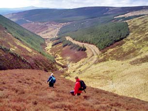
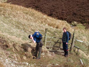
| You can see the vehicle track running into the distance in the picture below left. Once you are down through the bracken that you see in that picture you come to the gate shown in the second picture. The jackets come off now that we are not exposed to the cold blast further up the hill. Even the jersey is stuffed into the top of the pack. Anyone who walks the hills will know the routine of having to put on and take off gear at various stages of the day's walk. | ||
|
|
|
|
||
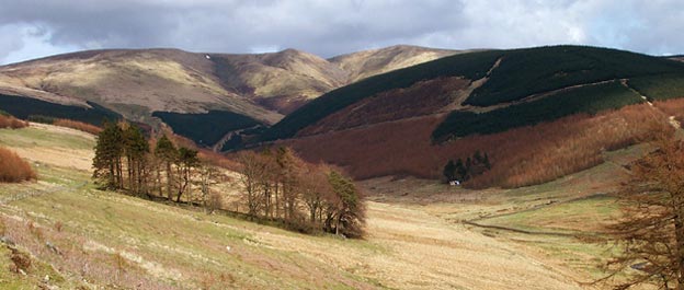
| You can see from the picture above that the view from the track back to where we have come from is still very pleasant. Next time you are travelling along the M74 glance over towards the Moffat hills and you will find Birnock Cloves quite easy to recognise with it's characteristic wee hump between the shoulders on either side of it. | ||