Hill walk routes to climb in SW Scotland
- also coastal paths and National Scenic Areas with maps, pictures and
other useful information based on extensive local knowledge
|
||
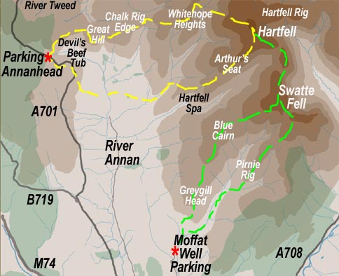
Swatte Fell from Moffat Well 1
|
||
This walk from Moffat Well (green route in the map below) starts just outside the town of Moffat. Take the A708 from the centre of Moffat heading for Selkirk. Before you leave the town you will see on your right a sign for Wamphray via the Old Carlisle Road. You don't take that, but you do take the road directly opposite it - turning left in other words (Ballplay Road). Carry along that till the road swings round to a T junction and turn right there. Follow this on up to a car park on your right at a gate with signs warning you about unexploded ordinance. Walk up the farm road from there and head up onto the hill in front of you | ||
![]() |
||
![]() |
![]() |
|
The picture on the left above shows the view as you walk up the farm road away from the car park. Head straight up the hill (Greygill Head) behind the house. The second picture shows the view back from the top of that hill back to where the car is parked and the town of Moffat beyond. The picture below shows the view as we head upwards from Greygill Head. You can see that the ground is gently rising with an easy surface to walk on + a wall to guide you. | ||
![]() |
||
In the picture on the left Sandy is sitting on the cairn at Greygill Head and we are looking NNE towards the Devil's Beef Tub and the source of the river Annan - below we are continuing up the ridge | ||
![]() |
||
![]() |
||
![]() |
||
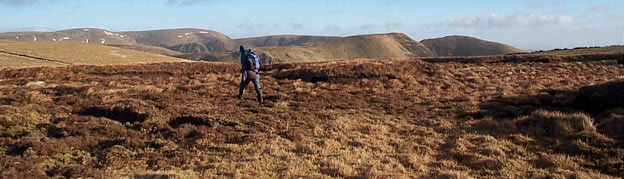
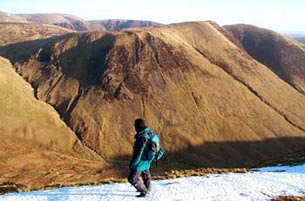
The picture above is taken as you arrive on the top
of Swatte Fell and begin to see Saddle Yoke, Carrifran Gans and White
Coomb. White Coomb is the hill just to the left of the figure, a thin
slice of Carrifran Gans is visible behind Saddle Yoke which is the double
top hill on the right |
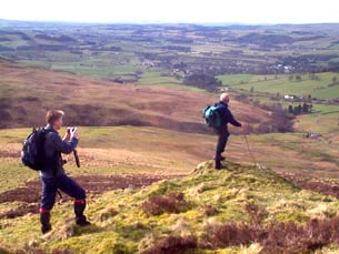
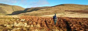
![]() |
|
![]() |
![]() |
![]() |