Hill walk routes to climb in SW Scotland - also coastal paths and National Scenic Areas with maps, pictures and other useful information based on extensive local knowledge
A Coastal walk from Kippford to Rough Island, Castle Point and Rockcliffe.
Introduction to East Stewartry National Scenic Area - Map of walking routes in the area
Site Homepage - Otherwalks Home - Otherwalks Page List - Rough Island Home
Click on the left side of the image below to go back to the previous page
or, on the right side of it to go to the next page.
View towards Rockcliffe and Kippford from beside Castle Point. View towards Rockcliffe and Kippford from beside Castle Point. View towards Rockcliffe and Kippford from beside Castle Point.
14 We are now on the top of Castle Point looking back over the route we have come with Rockcliffe beyond the field we came along the side of, and Kippford near the left edge of the picture. Between the two and quarter way in from the left of the picture is The Muckle which we will go up onto later in the day page 20.
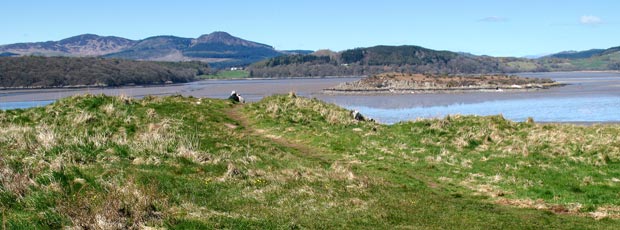
The second picture shows the view over to Rough Island, Screel and Bengairn - again from the top of Castle Point hill.
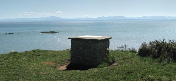
The third picture shows the view out past the information board out over the Solway Firth to the Lake District on the other side. In the web gallery of the walk from Portling to Castle Point there is a view of the contents of the information on this board.
View of Rough Island, Screel and Bengairn from Castle Point.
View of information board on top of Castle Point with the Solway Firth and the Lake District beyond.
Go to Page 13
Go to Page 15