or, on the right side of it to go to the next page.
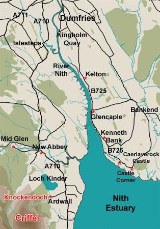
01 On the east bank of the River Nith the Nith Estuary National Scenic Area starts from Kelton and heads southwards down to Caerlaverock. There is plenty of space for parking, at the layby at Kelton, the pier at Glencaple, or the parking area at Castle Corner. You can also find other places to park for the odd car or two elsewhere along this stretch of the B725.
You can walk north or south from Kelton. As of 2012 new bridges have
been installed near the river bank north of Kelton which help with access
to the merse there. Heading south from Kelton there is a path to Glencaple
and from Glencaple there is a path running as far as Kenneth Bank. South
of Kenneth Bank you can still access the riverbank in places but here
there is little in the way of a path and you will need your wellies or
walking boots. From Castle Corner you can also walk over the merse either
up or down the river, but you have to watch what you are doing if you
go onto the actual river bed when the tide is out, the tides are fast
flowing and there are quicksands.
At Glencaple there is a hotel called "The Nith" where you can
get good pub grub. Since September 2012 there is a tearoom
on the pier at Glencaple. There is also a tearoom at Caerlaverock
Castle.
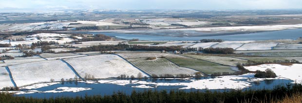
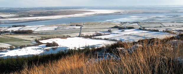
The pictures below are taken from the Mid
Glen to Criffel web gallery. They were taken from Knockendoch and
they offer a wide panorama of this stretch of the lower River Nith and
its estuary.