Hill walk
routes to climb in SW Scotland - also coastal paths and National Scenic
Areas with maps, pictures and other useful information based on extensive
local knowledge
Cairngarroch,
Cairnbaber, Millfore and Darnaw from Craigencallie
A
circular hill walking route over Cairngarroch, Cairnbaber, Millfore and
Darnaw from Craigencallie
Click on
the left side of the image below to go back to the previous page
or, on the right side of it to go to the next page.
or, on the right side of it to go to the next page.
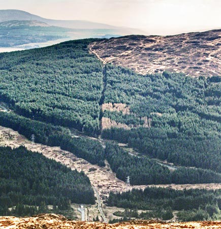
The dry stane dyke continues down through the firebreak which runs down straight towards us in the second picture. The dyke/firebreak brings you down to a forest road which you can see running down across the picture from left to right.
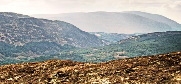
In the third picture we are looking south along the valley between Cairngarrock and Darnaw. We have Darnaw coming in from the left of the picture and you can see that it drops quite steeply into the valley. That shoulder where it drops into the valley is called Stair of Bennan and we will go up there later in the day to get onto Darnaw. The paler hills in the distance are first the long shape of Craignelder running across the picture, and then Cairnsmore of Fleet beyond it.