Capel
Fell, Loch Fell and Croft Head Round
Click on
the left side of the image to go back to the previous image and on the
right side of the images to go to the next image.
07
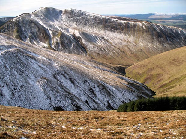
In the picture above we are looking south east and we now get the view
of Croft Head that I was looking for, making the effort worthwhile. The
Selcoth Burn runs down the valley that crosses the picture on this side
of Croft Head and the purple route shown on the map on page
01 would take us through that valley.
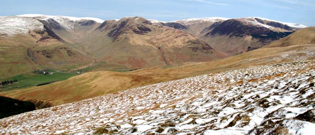
In the second picture we are looking north from the top of Capel Fell into the heart of the Moffat Hills with the deep valleys of the Blackhope Glen (on the left) and Carrifran Glen (on the right). We can now see the white top of Hartfell (808 metres) near the left edge of the picture. The hanging valley on the south end of Saddle Yoke (on the middle ridge between the two glens) is classic of its kind.
In the second picture we are looking north from the top of Capel Fell into the heart of the Moffat Hills with the deep valleys of the Blackhope Glen (on the left) and Carrifran Glen (on the right). We can now see the white top of Hartfell (808 metres) near the left edge of the picture. The hanging valley on the south end of Saddle Yoke (on the middle ridge between the two glens) is classic of its kind.