Hill walk
routes to climb in SW Scotland - also coastal paths and National Scenic
Areas with maps, pictures and other useful information based on extensive
local knowledge
Walking route from Ardwall to Criffel
Click on
the left side of the image below to go back to the previous page
or, on the right side of it to go to the next page.
or, on the right side of it to go to the next page.
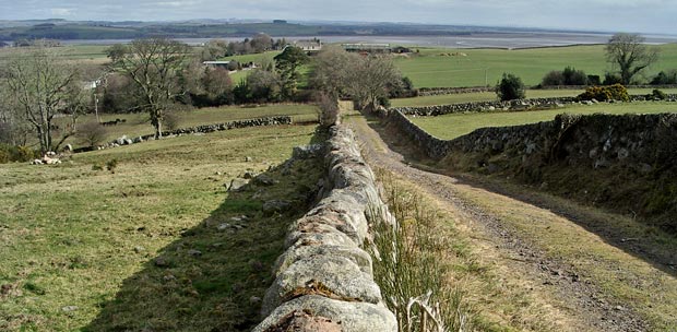
04 The
first part of the route is a vehicle track. The car park is among the
trees near the left edge in the picture above and that is the mouth of
the River Nith beyond.
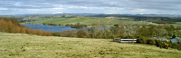
The water
you see in the picture below is Loch Kindar with Queensberry
already showing - snow covered and left of centre. The white topped Moffat
Hills are just right of centre and the Ettrick Hills still further to
the right.