Click
on the left side of the image to go back to the previous image and on
the right side of the images to go to the next image.
| Lowther Hill by Thirstane and Wether Hill | |||||
| Click
on the left side of the image to go back to the previous image and on
the right side of the images to go to the next image. |
|||||
|
|
|||||
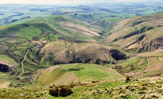
| 10 Zooming in on the route, the red asterisk marks where the car is parked and you can just see the line of trees and the hawthorns we passed to start with. The valley to the right of them is the valley of the Enterkin Burn running down to join the River Nith at Enterkinfoot. Nithsdale runs from right to left across the picture beyond where we parked - on it's way to the town of Dumfries and the Solway Firth beyond that. Unfortunately there was too much haze to see all that or the Lake District of England (beyond the Solway) which you can easily see on a clear day. | |||||
| |
|
|
|
||