Hill walk routes to climb in SW Scotland
- also coastal paths and National Scenic Areas with maps, pictures and
other useful information based on extensive local knowledge
|
|||||||
Grey Mare's Tail and
Loch Skene Routes (2)
|
|||||||
![]() |
![]() |
||||||
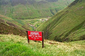
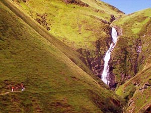
The picture above shows a view down to the car park from the path to Loch Skene. You can see how dangerous it would be off the path in wet conditions here, and how steep the ascent is direct from the car park to White Coomb - up the hill on the right in this picture. |
|||||||
The second picture shows the Grey Mare's Tail waterfall with some people on the low level path which goes up from the car park to near the bottom of the fall and no further. | |||||||
![]() |
![]() |
||||||
The picture on the left above shows Mid Craig and Lochcraig Head from Loch Skene - a fair reward for your climb so far. The picture on the right is the view from the top of Lochcraig Head (801m) down Loch Skene. At the far end of the Loch near the left hand side of the picture you can see where the Tail Burn runs out of the Loch and down to the falls. That's where the above left picture was taken from. Mid Craig is in the right foreground with White Coomb beyond it. The Ettrick hills can be seen on the far side of Moffat Dale | |||||||
![]() |
![]() |
||||||
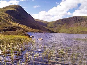
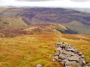
Above left we are on Mid Craig looking back to Lochcraig
Head. The hill you can see through the saddle is Broad Law with it's aircraft
tracking station on top (not visible in this small picture). Broad Law
is just 3 metres short of being the highest hill in the South of Scotland
- Merrick being the highest at 843m. Above right is the view coming down
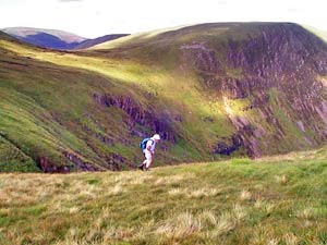
off Mid Craig heading back for Loch Skene. The Tail Burn is visible running
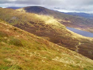
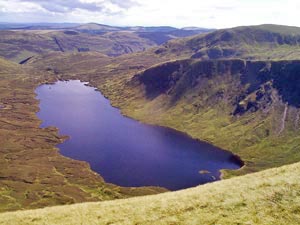
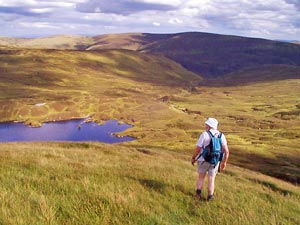
from the loch down to the falls. On the right is the view from Mid Craig
over the head of Loch Skene to Lochcraig Head. You can see that the climb
from the loch up onto Lockcraig Head is quite a long steady climb 300m
or nearly 1000ft from the loch to the summit - but the surface is like
a carpet once you get much above the loch. |
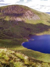
|||||||
![]() |
|||||||
and finally Broad Law in the distance to the left of Lochcraig Head. Below right shows the line of descent from White Coomb back down to Grey Mare's Tail. You follow the dyke down and then traverse left to the Tail Burn (orange and green routes on the map). There is a ridge walk along the Ettrick hills on the far side of Moffat Dale, the Bodesbeck Ridge, which offers excellent views over the Dale into the Moffat hills some of which we used on the previous page. | |||||||
![]() |
![]() |
||||||
![]() |
![]() |
![]() |
![]() |
![]() |
![]() |
![]() |
![]() |