Hill walk
routes to climb in SW Scotland - also coastal paths and National Scenic
Areas with maps, pictures and other useful information based on extensive
local knowledge
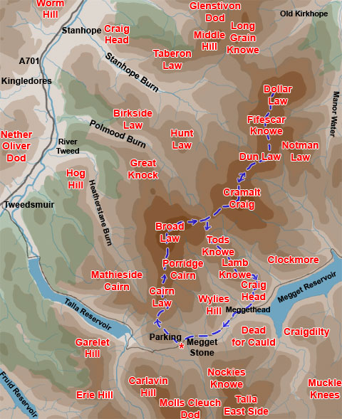
Broad
Law and Dollar Law
Map
of a linear hill walk from the Megget Stane into the Manor (or Tweedsmuir)
Hills, over Broad Law, Cramalt Craig, Dun Law, Fifescar Knowe to Dollar
Law returning by Meggethead.
Click on
the left side of the image below to go back to the previous page
or, on the right side of it to go to the next page.
or, on the right side of it to go to the next page.
You can access the Megget Stane from either the A701 at Tweedsmuir village or the A708 from Cappercleuch on St Mary's Loch. The road which joins these points is single track road with passing places and is not classified on the map. It is a road that is well worth driving over even if you don't take to the hills by foot. As you will see on page 04 the Megget Stane snuggles up close to a gate by a cattle grid and it is very easy to miss, but if you remember that it is at the highest point on the road after you have climbed up from the Talla Reservoir, or before you descend down to the Talla and it's beside a cattle grid you can't go wrong.
These pictures were taken on 9th July 2008 and I took 6 hours 43 minutes to do the route at a leisurely pace.