Capel
Fell, Loch Fell and Croft Head Round
Click on
the left side of the image to go back to the previous image and on the
right side of the images to go to the next image.
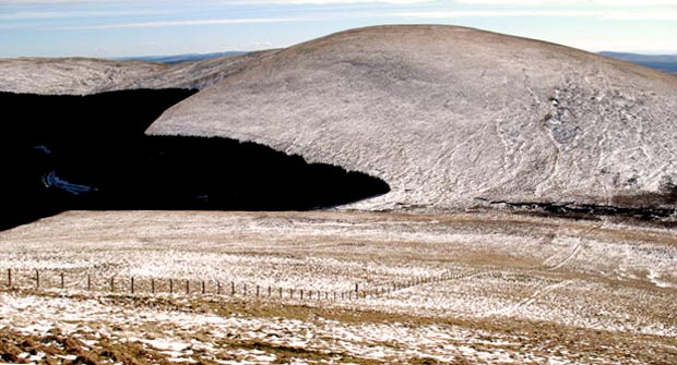
09 That's Wind Fell (665 metres)
in front of us in the picture above. You could go up there and along the
tops to Ettrick
Pen, come off Ettrick Pen and cross the River Ettrick and over by
Bodesbeck back to Moffat Dale - which we've done a few times. It's quite
a fine walk too as you will see its web gallery - in snow conditions.
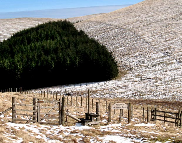
The SUW passes across the picture through this hollow between Capel Fell and Wind Fell and enters the Borders Region of Scotland just where the fence that you see running down off the top of Capel Fell gets to the bottom of the hollow. The fence line marks the border between Borders and Dumfries and Galloway and this fence/border continues straight up onto Wind Fell where it turns left (north east) and heads along to Ettrick Pen. We are on the Dumfries and Galloway side of this border in these pictures.
In the second picture we are down at the SUW and as you can see the sign welcomes you into the Borders Region. The hill coming down from the right is Wind Fell and the hill beyond the trees is Hopetoun Craig. The SUW goes into the trees at this point not up by the fence line. You would soon come to the source of Ettrick Water if carried on in that direction.