Hill walk
routes to climb in SW Scotland - also coastal paths and National Scenic
Areas with maps, pictures and other useful information based on extensive
local knowledge
Around
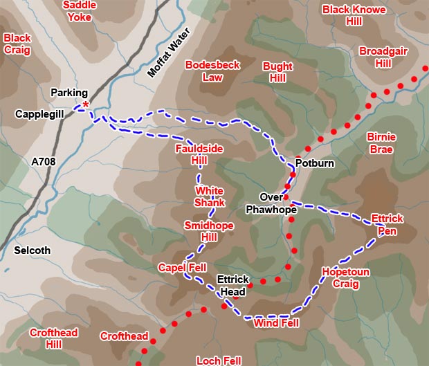
Ettrick Head - Capel Fell, Wind Fell and Ettrick Pen in Winter
Map
of a circular walking route in the Ettrick hills around Ettrick Head -
over Fauldside Hill, White Shank, Capel Fell, Wind Fell, Hopetoun Craig
and Ettrick Pen - from Capplegill on Moffat Water.
Click on
the left side of the image below to go back to the previous page
or, on the right side of it to go to the next page.
or, on the right side of it to go to the next page.
You could then come back on another day and do the other half of the route. I took seven hours and ten minutes to the blue route in tough snow conditions, plus, as you will see I took plenty of photographs and that takes time. You could also add Bodesbeck Law to the route if you wanted and we have done this in the past.
The range of hills which lie north west of the A708 is the Moffat hills and the range of hills to the south east where we are going today is the Ettrick hills. The Moffat hills will offer a fine backdrop to our day's walk for most of the day. You can see a map of the whole area by clicking on the Large Map of West Borders Hills which you will find among the links at the top of every page.