Hill walk
routes to climb in SW Scotland - also coastal paths and National Scenic
Areas with maps, pictures and other useful information based on extensive
local knowledge
Portling
to Castlehill Point - A Coastal Walk
Click on
the left side of the image below to go back to the previous page
or, on the right side of it to go to the next page.
or, on the right side of it to go to the next page.
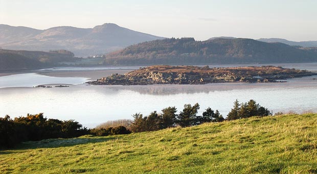
15 Before we descend to
Castlehill Point we get the above view over Rough Firth and Auchencairn
Bay with Bengairn and Screel beyond.
Zooming-in in the picture below we can see Rough
Island and Screel with the Almorness peninsula lying between them.
The map shown on page 01 shows Rough
Firth at low tide and you can see that there is a causeway out to the
island which is useable for a couple of hours either side of low tide.
It is also possible to walk out to Hestan Island at low tide.