Hill walk
routes to climb in SW Scotland - also coastal paths and National Scenic
Areas with maps, pictures and other useful information based on extensive
local knowledge
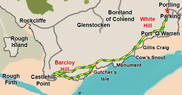
Portling
to Castlehill Point - A Coastal Walk
Map
of a walk in East Stewartry National Scenic area from Portling to Castlehill
Point
Click on
the left side of the image below to go back to the previous page
or, on the right side of it to go to the next page.
or, on the right side of it to go to the next page.