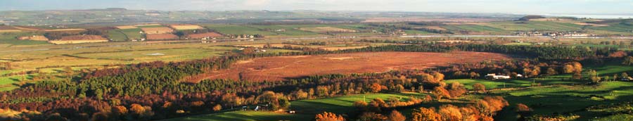
05 Pictures cannot really catch the full grandeur of scenery that you get in real life. I have made this page of panoramic images to try to catch some of the breadth of the experience. Above is view of the Lake District from Mabie Forest Park with Skidaw in the middle of the picture.
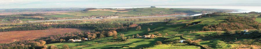
In the second picture we are looking down on the Kirconnell Flow from Mabie. Kirconnel Flow is the large orange/brown area in the foreground. You can see the River Nith running out into the estuary with Glencaple village near the right edge of the picture and Kelton left of centre.
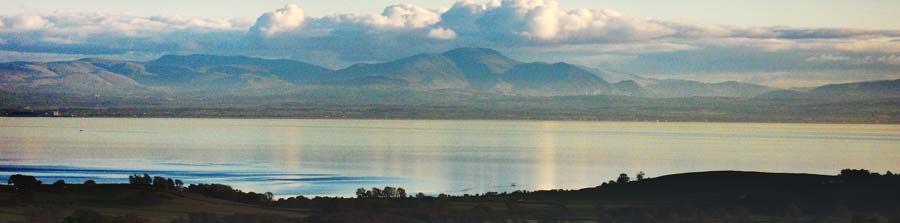
In the third picture we have moved the camera further to the right (south). The south end of Kirconnell Flow is on the left of the picture, Glencaple is just left of centre, Ward Law is the dark shape on the crest of the hill to the right of Glencaple and Caerlaverock is to the right of that again where you can see the river widen. That's the Solway Firth and the Cumbrian coast of England in the distance.