Walking route from Mid Glen to Criffel via Knockendoch
or, on the right side of it to go to the next page.
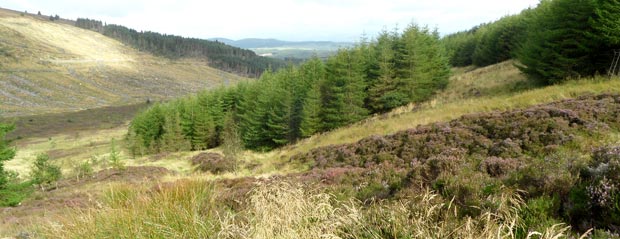
12 The end of the forest track is quite close to the red asterisk point shown on page 11. After that you are going through a forest ride (or fire break if you prefer) for a considerable distance. On 5th September 2012 I was at the red asterisk point at 10.30am according to my camera and I did not get to the far end of the forest ride untill 11.52am. So that was an hour and twenty two minutes of plodding through really awkward terrain with very little of a path and nothing of a view except trees. I don't really recommend it for most people for whom good easy walking is the most important part of a day's walk. The picture above shows what it is like going through the corridor made by the trees.
However this route does have some pluses. You are not likely to meet anyone and so you have what is a relatively undisturbed flora and fauna to yourself. It is quite a private, almost secret, place to be in your own wee enclosed world with just plants, birds and animals for company. There were plenty of blaeberry plants but hardly a blaeberry to be found on them and the main culprit I'm sure was deer. I caught a glimpse of one and in the later stages of the walk it is deer tracks that make life slightly easier for the walking, though you need a walker's eye to find them.
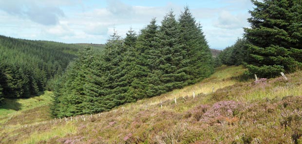
The second picture was taken at a break in the forest ride where the Pultarson Burn comes down off Criffel. I am looking back across the break here and you can see the forest ride I have just come through (near the right edge of the picture). Down in the left corner of the picture you can see where the Glen Burn runs but you hardly ever see it for the rest of the time because of the trees, nor can you hear it. From this point on you are looking for those deer tracks I mentioned. This picture was taken at 11.15am.
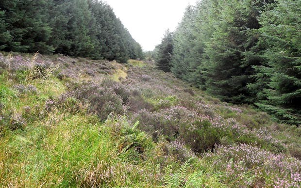
The third picture shows the southern end of the forest ride (11.52am and thank goodness to be here). From here you go NE (up the hill to the right in this picture) onto Criffel and if anything the terrain going up there is even worse - you are never sure when you put your foot down whether it will be in a hole or top of a shaky hump of vegetation.
However this is the third time I have come this way and the first time I was up with my pal Sandy sometime in the early 2000s we came across what we took to be the remains of an old tractor or something like that and we didn't think much more about it except to wonder how it ended up there. However I have since learned that an Anson Mk 1 crashed on Criffel on 4th November 1944 and I wondered if I could find that old "tractor" again for a better look. No joy I'm afraid this time. I was in the right area but possibly just not quite far enough north. I didn't have the grid reference with me or the necessary map to find it on. It is very awkwards discouraging terrain to be searching just on the basis of a vague memory from the past. Sandy tells me he can't even remember seeing it at all. I'll need to go back with the grid reference and a map.
Two weeks late on 19th September 2012 I went back up and found the remains of the Anson.