Walking route from Mid Glen to Criffel via Knockendoch
or, on the right side of it to go to the next page.
11 The picture above was taken in September 2012. I was revamping this web gallery and I wanted shots for these last two pages to show an alternative way of returning to Mid Glen and of giving some indication of what the route up by the Glen Burn onto Criffel from the west is like.
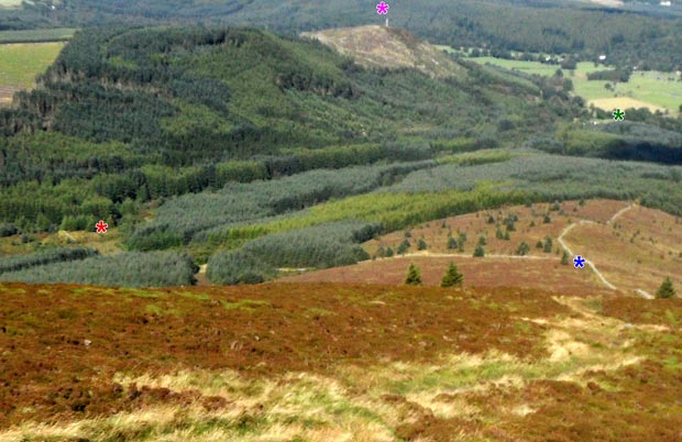
This picture above has 4 asterisks in it. At the blue asterisk you can leave the route we ascended by and instead of following the dyke straight down you can turn left and make your way down the other dyke which takes you down to where the red asterisk is. Look out for a path vearing off to the left as you approack the dyke but even if you miss that you can go along this side of the wall till you find the path (of sorts!). This is an awkward bit of irregular terrain to cross but it is a much shorter length of awkwardness than following the dyke straight down especially if conditions are very skittery with mud or icy. The purple asterisk near the top of the image shows where the Waterloo monument is. The monument is a hollow cylinder and you can get up the inside of it to the top. The green asterisk near the upper right side of the image shows where we parked at Mid Glen.
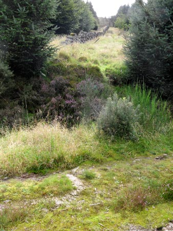
The second picture is taken from where the red asterisk is in the picture above and shows where the dyke you have come down meets the forest track which was mentioned on page 01. The rough forest track is visible in the foreground. Coming down this alternative route you would turn right when you meet the forest track and then follow it down till you find the way-marked marker where you turn left off it for Mid Glen.
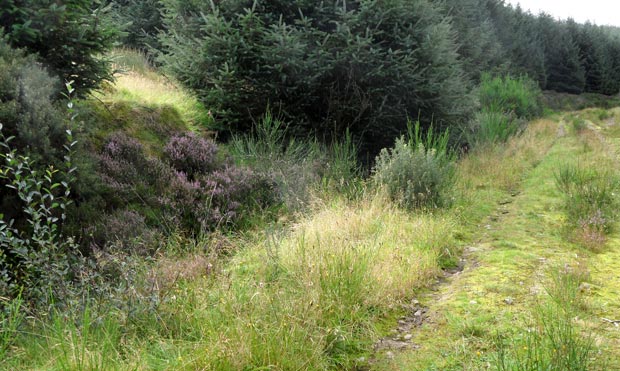
The third picture was also taken at the red asterisk point and shows both a view looking up the forest track and also where the alternative route off Knockendoch joins it (the bright patch on the left of the picture). On page 01 I mentioned the possiblity of walking along this track and up the east bank of the Glen Burn allowing you to come onto Criffel from the west. Page 12 shows some images from that route.