Hill walk routes to climb in SW Scotland - also coastal paths and National Scenic Areas with maps, pictures and other useful information based on extensive local knowledge

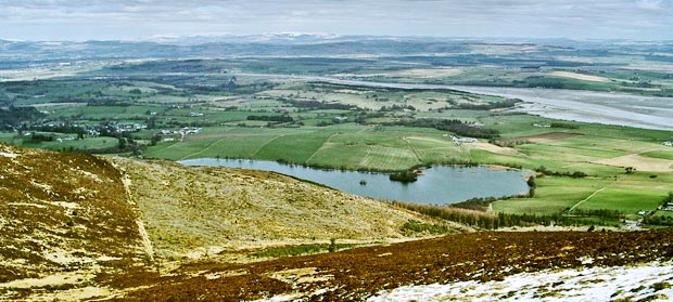
Walking route from Ardwall to Criffel

Site Homepage - Otherwalks Home - Map of River Nith Estuary - List of Otherwalks Pages Ardwall to Criffel Home Page - Mid Glen to Criffel
Click on the left side of the image below to go back to the previous page
or, on the right side of it to go to the next page.
View looking north-eastward over Loch Kindar and the River Nith towards Glencaple and Caerlaverock, from near the top of Criffel View looking north-eastward over Loch Kindar and the River Nith towards Glencaple and Caerlaverock, from near the top of Criffel View looking north-eastward over Loch Kindar and the River Nith towards Glencaple and Caerlaverock, from near the top of Criffel
08 In the picture above we are looking back down the shoulder we have just come up. You can see where the car is parked near the right edge of the picture. That's Loch Kindar with it's crannog and beyond it the Nith estuary with the village of Glencaple on the far away bank just about the middle of the picture. The Moffat and Ettrick hills are in the distance, New Abbey is near the left edge of the picture and above that you can see part of Dumfries. Sweetheart Abbey in New Abbey dates back to the 13th Century.

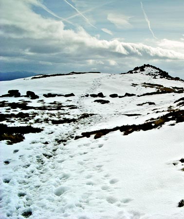
Below is Douglas's cairn at the top of Criffel. You can see that even in snow conditions this is a popular walk. As with all popular routes there is errosion caused and the ground can therefore be a bit soggy in places especially once you get above the tree line as mentioned earlier.
View of Douglas's cairn at the top of Criffel
Go to Page 07
Go to Page 09