Hill walk routes to climb in SW Scotland
- also coastal paths and National Scenic Areas with maps, pictures and
other useful information based on extensive local knowledge
Comb Law, Rodger Law,
Ballencleuch Law and Scaw'd Law hill walking route
Click on the left side of
the image below to go back to the previous page
or, on the right side of it to go to the next page.
or, on the right side of it to go to the next page.
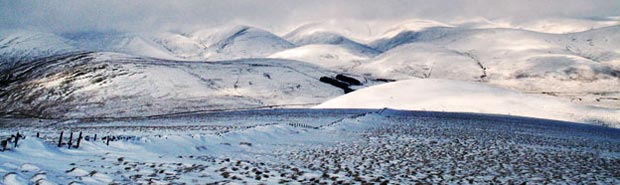
In the second picture we have moved the camera a few degrees to the west. The trees at Overfingland are now in the middle of the picture and Green Lowther is vertically above them in this picture as the cloud thins to let the sunlight through to the Lowthers. You can see where the SUW runs up from Overfingland over Comb Head and Cold Moss to Lowther Hill on the left of the picture.
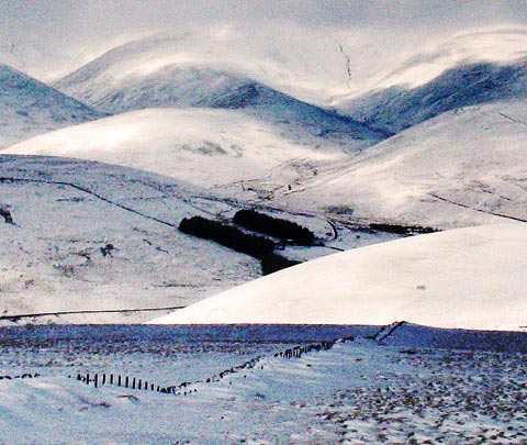
In the third picture I have zoomed in to Overfingland and Riccart Cleuch above it where we came down on the SUW/Lowther walk. Meikle Shag is the round white shape in the foreground.