| Hill walk routes to climb in SW
Scotland - also coastal paths and National Scenic Areas with maps, pictures
and other useful information based on extensive local knowledge |
| Glenleith and Wedder Law Hills
from Morton Castle (Page 1) |
(Click
here to go to page 2)
Lowthers
- Main
Lowthers Map - Lowther
Hill - Durisdeer
and Dalveen Pass - Site
Homepage - Queensberry |
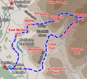
| In most of the other maps
on this site I have drawn the contours at hundred metre intervals from three
hundred feet upwards. In this map however, I have added a 250 metre contour
so that the shape of East Morton Hill shows up with it's characteristic
undulating dog leg ridge. You can see both from this map and from the photographs
below that the first stage as far as the bothy is easy going even if it
is a wee bit up and down. There is quite a steep descent to the bothy and
then a steady climb up onto Glenleith and Wedder Law. Coming down through
Cample Cleuch is a bit of a scramble in places but well worth the effort.
If you don't fancy that you can take the longer but easier track around
the north end of Bellybucht Hill, or go straight over the top of it which
offers awkward terrain but a good view as you descend to Morton
Castle. Sandy and I have been on this route a couple of times - it takes
us around six and a half hours. |
 |
 |
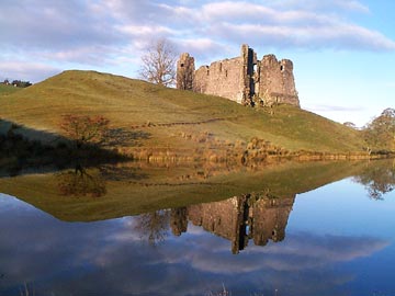 |
Morton Castle, where we start
from on this walk, is not one of the better known tourist attractions in
Scotland. It lies off the back road (not the A702) from Thornhill to Durisdeer
Village. Like so many places in this SW corner of Scotland, both the
castle and Durisdeer village are quiet unsung places very well worth visiting.
The "afternoon teas" run by the local women in the church hall
at Durisdeer on a summer Sunday afternoon, with all the home baking, is
worth a visit in itself. But then there is the Italian marble tomb in the
church and the Roman fort close by - and the peaceful setting of the place.
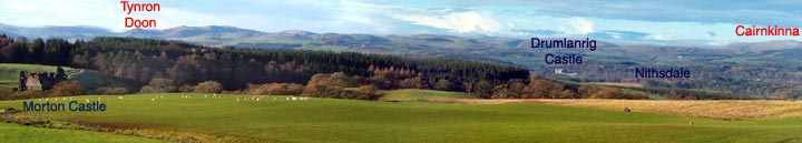
The picture above shows the general view across the valley of the River
Nith to the much more visited Drumlanrig
Castle (home of the Duke
of Buccleuch) and the Scaur Hills beyond it and the picture on the left
shows the castle. |
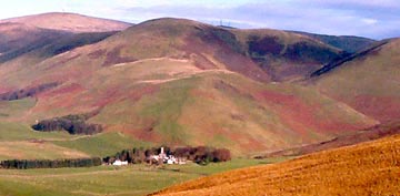 |
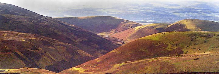
The picture on the left being
a blown up section of a picture which was in itself not all that great is
of poor quality but it does show rather well how Durisdeer nestles into
the bottom of yet another undulating dog leg ridge. Seen from a distance
you can easily mistake one ridge for the other. If you look very closely
you can just make out the "golf ball" on the top of Lowther Hill
near the left side of the picture and the more prominent masts on the top
of Green Lowther. This shot was taken from East Morton Hill. |
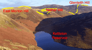
| The shot on the right shows
the route we are to travel above the Kettleton Reservoir. Glenleith Hill
has been a bit of a jinx for us - we have had a lot of rotten weather on
it. We had been over the top several times before we saw anything except
mist. The top is nothing special anyway, being small, flat and characterless,
with no great view. The view on the ascent of it is another matter as you
can see from the picture below which shows clearly the route we have come
up and the alternative track round the north end of Bellybucht hill mentioned
above. |
 |
 |
| (Click
here to go to Glenleith and Wedder Law Hills page 2) |
|
|