Glenochar Bastle
House and Fermtoun
Click on the left side of
the image below to go back to the previous page
or, on the right side of it to go to the next page.
or, on the right side of it to go to the next page.
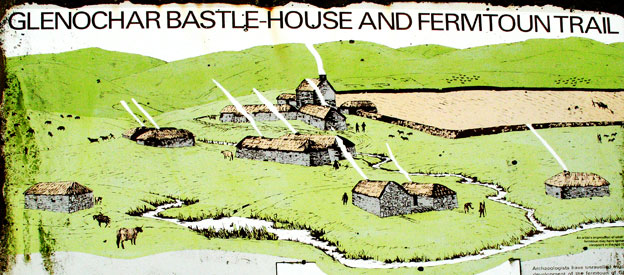
There are plenty of information boards around the Bastle and Fermtoun Trail with excellent information on them. However as you can see in the picture below these boards are weathering badly. The picture does give you a good idea what the place would have looked like around 1600 AD.
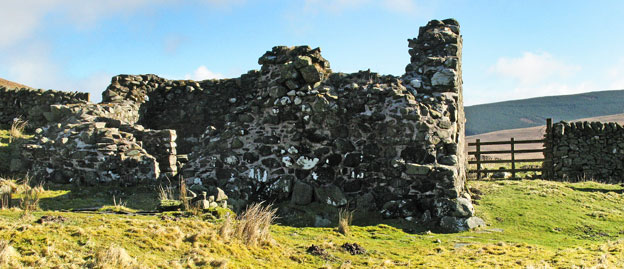
The third picture lets you see what the bastle looks like now.