Rhinns of Kells from
Fore Bush (2) - via Milldown, Millfire and Corserine
A circular hill walking
route from Fore Bush onto the Rhinns of Kells in the Galloway Hills via
Milldown, Millfire and Corserine
Click on the left side of
the image to go back to the previous image and on the right side of the
images to go to the next image
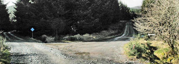
04 In the
picture above we are at the point where what the Estate calls the Pipeline
Road goes to the right from the track we are on. I have marked this in
yellow on the the estate map but I don't recommend it in wet conditions
unless you are happy to be up to the ankles in mud as I found on 18th
March 2009. In drier conditions it would offer a slight shortcut and would
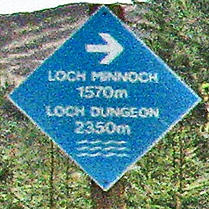
let you have a look at Loch Minnoch in the passing. The blue sign says
"Loch Minnoch 2545m" and "Loch Dungeon 3325m" and
the arrow points forward in the direction we are heading - we will pass
road ends which take you to these lochs.
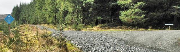
In the second picture we are at the point where we do turn right off the track we have been on so far and a light misty rain (a "smirr" of rain in Scots) was beginning to start.
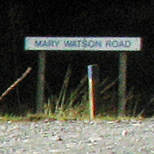
In the final two pictures I have zoomed in digitally to the second picture to let you see what the signs say - excuse the quality! Notice the marker with the blue top underneath the Mary Watson Road sign. This is one of the way-markers that you will find along this route which the estate calles the "blue route".
In the second picture we are at the point where we do turn right off the track we have been on so far and a light misty rain (a "smirr" of rain in Scots) was beginning to start.
In the final two pictures I have zoomed in digitally to the second picture to let you see what the signs say - excuse the quality! Notice the marker with the blue top underneath the Mary Watson Road sign. This is one of the way-markers that you will find along this route which the estate calles the "blue route".
Page 05 -