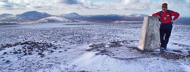
Rhinns of Kells from
Craigencallie
A linear hill walking route
from Craigencallie onto the Rhinns of Kells going over Darrou, Little
Millyea, Meikle Millyea, Milldown, Millfire and Corserine
Click on the left side of
the image to go back to the previous image and on the right side of the
images to go to the next image
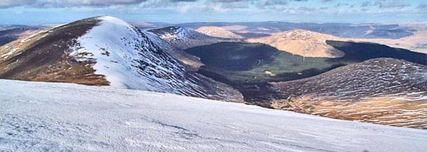
The second picture shows the view northwards from Corserine up into Ayrshire. Mouseover to see the names of these hills at the north end of the Rhinns of Kells.
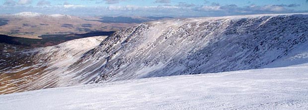
In the third picture we have swung the camera to the right (east) and that is Polmaddy Gairy forming the right side of this great horseshoe of ridges that runs north off the top of Corserine. That's Cairnsmore of Carsphairn near the left edge of the picture.
Page 11 -