Hill walk routes to climb in SW Scotland
- also coastal paths and National Scenic Areas with maps, pictures and
other useful information based on extensive local knowledge
North Manor Hills
Click on the left side of
the image below to go back to the previous page
or, on the right side of it to go to the next page.
or, on the right side of it to go to the next page.
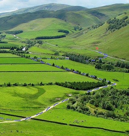
The pictures below are blow-ups from the above picture to show the route. The red asterisk shows where the car was parked. The river that you see is the River Tweed, running towards you. Just after you come down off the road you cross a bridge over the river. That's Gathersnow Hill in the distance, but the valley that you see just to the left of the car is not that of the Kingledores Burn that you saw in page 01. Kingledores is out of the picture on the left further upstream in the Tweed Valley.
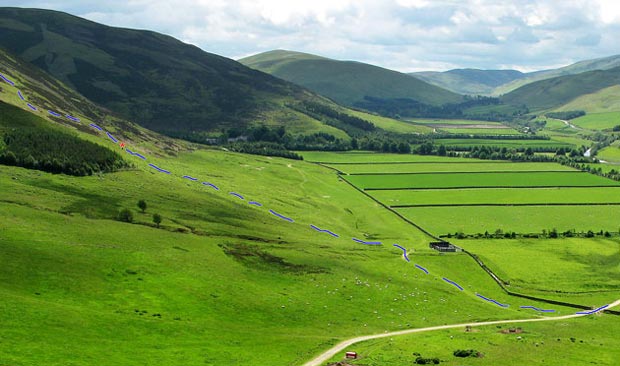
In the second picture below you will again see a red asterisk. This is the point where I got beyond the environs of Stanhope by climbing over an electric fence. This sounds like something you definitely don't want to do but as you will see on page 05 it is not really so desperate. Stanhope House lies in the shade of the trees just to the right of the red asterisk and I was happy to keep well away from there.