or, on the right side of it to go to the next page.
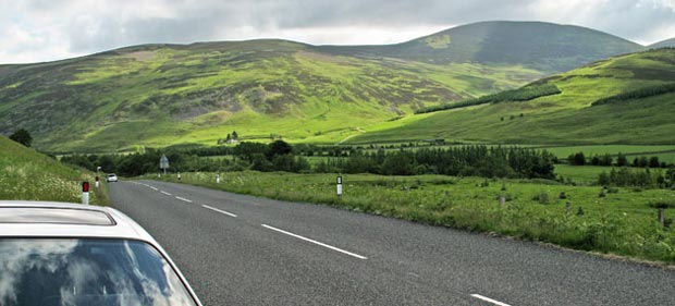
02 The picture above shows where I parked by the side of the A701 at
Ordnance Survey reference NT114303 very close to the 221 metre mark on
the Landranger Map. That's my car in the foreground. Beside the other
car heading into the distance you can see a sign by the roadside which
reads "Stanhope Private Road". In spite of the "private
road" business I took my car down there to see if I could park out
of the way somewhere and off the main highway - you can't so don't bother
trying.
My route would take me up Craig Head on the right of the picture to start
with and I would come down over the dark domed top of Drumelzier Law which
you see beyond it, and end up by descending from the ridge near the house
with the trees beside it that you see left of centre below below Dulyard
Brae.
But first I had to get from where I was parked past the "private"
stuff and onto the freedom of the hill and even though we have the "right
to roam" in Scottish law I was still uneasy that for the first time
I might get some grief here getting past the environs of Stanhope House.
These fears proved to be unfounded on this occasion.