Hill walk routes to climb in SW Scotland - also coastal paths and National Scenic Areas with maps, pictures and other useful information based on extensive local knowledge
Around St Mary's Loch
Site Homepage - West Borders Home - Large Map of West Border Hills
List of West Border Web Pages - St Mary's Home
Click on the left side of the image below to go back to the previous page
or, on the right side of it to go to the next page.
Descending to the Megget Water at Henderland and looking up to the reservoir. Descending to the Megget Water at Henderland and looking up to the reservoir. Descending to the Megget Water at Henderland and looking up to the reservoir.
14 Here we are descending to the Megget Water at Henderland and we are looking up to the Reservoir. The road that you see is not classified on the map, but is quite a spectacular road to drive taking you over to Tweedsmuir on the A701, past both the Megget and Talla reservoirs and also the Megget Stane between them which offers a high start at 452 metres into the hills on either side of the valley - the Moffat hills to the left (south west) and the Manor Hills to the right.
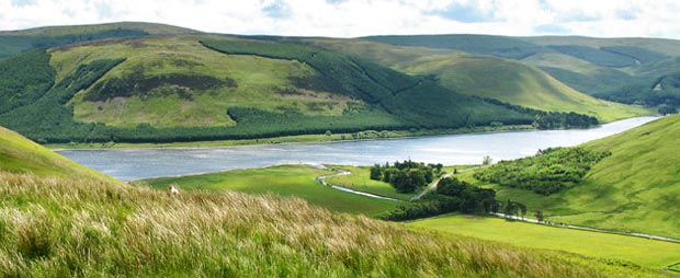
The picture below shows just how flat the Southern Upland Way is at this point - it follows the water's edge the length of the loch. The loch surface itself is almost exactly 250 metres above sea level.
View to Cappercleuch and St Mary's Loch as we descend from Henderland Hill.
Go to Page 13
Go to Page 15