or, on the right side of it to go to the next page.
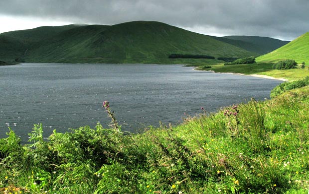
03 Above is a view of the
Megget Reservoir as we begin to head SW along it's shore. As you can see
the weather is not very promising, but there is some brightness trying
to break through the gloom.
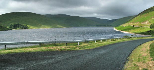
In the second picture, as we approach the SW end of the reservoir we get
the hill called Dead for Cauld which we will head for at the start of
our walk. From there we can not only get views along the length of the
reservoir, but we can also get views of the route we came down from Cramalt
Craig and Broad Law just the week before, which will help to bring the
layout of the whole area together so that we feel we know it's personality
from all angles. Dead for Cauld is the dark brooding hill right in the
middle of the picture and Carlavin Hill which we will descend at the end
of the day is to the right of it in the distance.
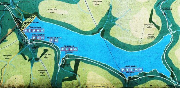
The third picture is a map taken from one of the information boards which
you find at the various parking places along this side of the reservoir
- which are shown on the map. Dead for Cauld is just off the map to the
right. The water authorities have provided quite a number of these information
boards but unfortunately they are beginning to weather quite badly. To
see more pictures taken from these boards click
here.