Capel
Fell, Loch Fell and Croft Head Round
Click on
the left side of the image to go back to the previous image and on the
right side of the images to go to the next image.
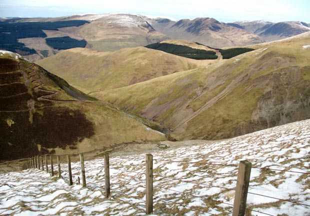
13 Starting the descent off
West Knowe we get the view above over to where the new high route of the
SUW comes along the top of the hill opposite - with Queensberry and the
Lowthers in the background. Going by the map that face opposite is called
Crookedside Slenders.
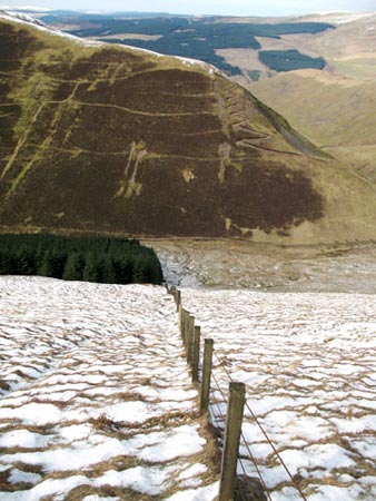
In the second picture we are looking north from the top of West Knowe over to Broken Back and the Moffat hills beyond. The second picture on page 05 was taken from Broken Back looking exactly over here. That's the new zigzag track they have put up on Cat Shoulder for an alternative route of the SUW. I don't think I fancy that too much - it's made a real mess of a favourite route of ours. Notice the sheep pen down there which is at the confluece of all the various routes on the map on page 01. That's the Selcoth Burn running down the gully from it.
In the third picture you can see that it is quite a steep descent off West Knowe. I stayed with the fence to stop sliding in the snow.