Hill walk routes to climb in SW Scotland - also coastal paths and National Scenic Areas with maps, pictures and other useful information based on extensive local knowledge
Beninner, Cairnsmore of Carsphairn and Moorbrock
Site Homepage - Scaur Home - Large Map of Scaur Carsphairn Hills - Moorbrock Home
List of Scaur Pages
Click on the left side of the image below to go back to the previous page
or, on the right side of it to go to the next page.
Beninner from the valley of the Bow Burn. Beninner from the valley of the Bow Burn. Beninner from the valley of the Bow Burn.
16 Above is the view looking south across the lower reaches of Cairnsmore towards Beninner as we get down towards the valley between Cairnsmore and Moorbrock. There is a watershed half way along this valley from which the Poldores Burn runs south east to feed into Water of Ken and the Bow Burn runs north west then south west to join Water of Deuch close to Knockengorroch some 4 kilometres north of Carsphairn village.
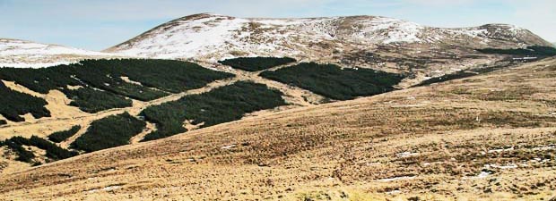
In the second picture we are looking across the valley to Moorbrock. You can see the cross running diagonally through the trees. To get onto Moorbrock we will go up to the left from where the arms of the cross meet on the vehicle track - up the left arm of the cross.
Moorbrock Hill and the route to it from the Bow Burn
Go to Page 15
Go to Page 17