Hill walk routes to climb in SW Scotland - also coastal paths and National Scenic Areas with maps, pictures and other useful information based on extensive local knowledge
Portling to Castlehill Point - A Coastal Walk
Introduction to East Stewartry National Scenic Area - Map of walking routes in the area
Site Homepage - Otherwalks Home - Otherwalks Page List - Portling Home
Click on the left side of the image below to go back to the previous page
or, on the right side of it to go to the next page.
View of the route ahead after White Hill on the coastal walk from Portling to Castle Point. View of the route ahead after White Hill on the coastal walk from Portling to Castle Point. View of the route ahead after White Hill on the coastal walk from Portling to Castle Point.
07 This stretch of the route follows the edge of the field and is over well cropped grass with fine open views as you can see above. There are one or two quite high dykes to cross but they have projecting stones built into them to help you cross.
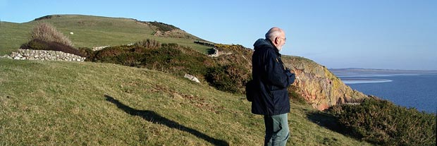
In the picture below you can see Cow's Snout just to the right of Sandy. You can also see the winding route we have come from White Hill. We are now about to leave the open field and start on a section which goes through gorse ("whins" in Scots).
View back to White Hill on the coastal walk from Portling to Castle Point.
Go to Page 06
Go to Page 08