Hill walk
routes to climb in SW Scotland - also coastal paths and National Scenic
Areas with maps, pictures and other useful information based on extensive
local knowledge
Walk to Hestan Island from Balcary Bay
Click on
the left side of the image below to go back to the previous page
or, on the right side of it to go to the next page.
or, on the right side of it to go to the next page.
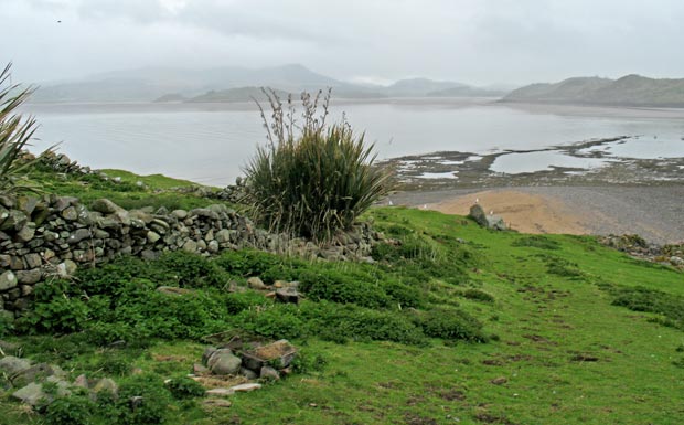
09 Above
is a view from above the house looking over the causeway to Almorness
peninsula with Screel near the left edge of the picture. You can see how
the water's edge was curving into the bay still - forcing you over towards
Almorness before you get onto the causeway.
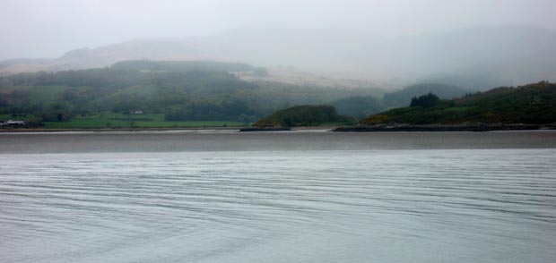
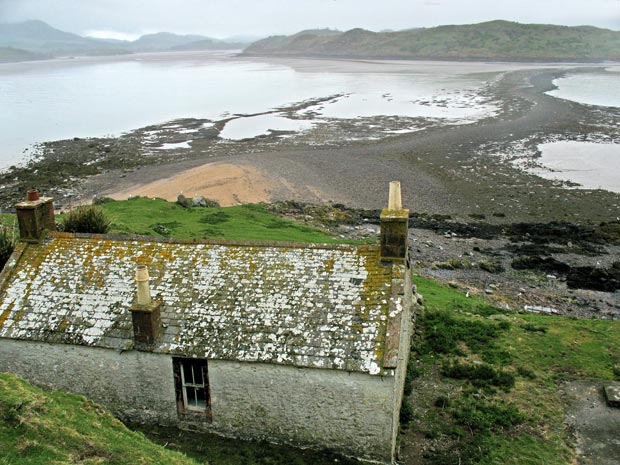
In the second picture I have swung the camera to the left (westward) and you can see the Screel/Bengairn range shrouded in mist. There was what we in Scotland would call a "smirr of rain" - a very light drizzle - on the island all the time while I was there. The dark hump in front and slighty to the left of Screel is Torr Point which you can see better on the right side of the third picture. The beach that you see over there is Red Haven beach, a very pleasant place as you can see in that web gallery. The mud is really bad on the east side of the bay over there.
In the second picture I have swung the camera to the left (westward) and you can see the Screel/Bengairn range shrouded in mist. There was what we in Scotland would call a "smirr of rain" - a very light drizzle - on the island all the time while I was there. The dark hump in front and slighty to the left of Screel is Torr Point which you can see better on the right side of the third picture. The beach that you see over there is Red Haven beach, a very pleasant place as you can see in that web gallery. The mud is really bad on the east side of the bay over there.