or, on the right side of it to go to the next page.
05 There is a track which
goes down to the end of Glen Isle and there are chalets on the west side
of this tiny peninsula. Looking west from Kippford you would not know
they were there but from this angle looking NE as we make our way across
the head of the small bay that separates Glen Isle from the Almorness
peninsula you can see them.
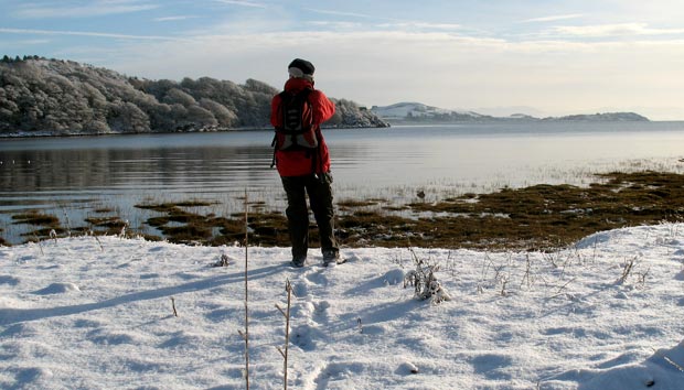
In the first picture below (looking SE) we see the tip of Glen Isle peninsula
just to the right of Allan, Barcloy Hill to the right of that and Castlehill
Point near the right edge of the picture. You can also see the hills of
the Lake District (faintly) beyond that on the far side of the Solway
Firth.
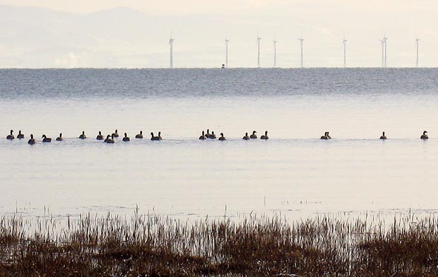
Looking straight out into the Solway in the second picture below we see
part of the recently commissioned Robin
Rigg wind farm.