or, on the right side of it to go to the next page.
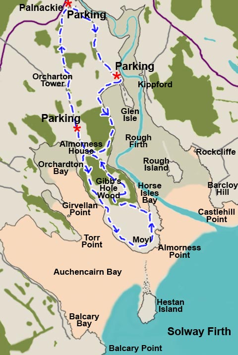
01 The walk shown in this
web gallery starts from Palnackie
and follows a figure of eight down the Almorness Peninsula as shown in
the blue route in the map above. Palnackie is a small village so there
is no problem parking here. There are two other possible parking places
shown on the map the use of either of which would shorten the day's walk
- one just north of Glen Isle and one just north of Almorness house.
On the day we did this walk (Tuesday 8th December 2010) Scotland was in
the middle of a prolonged and deep cold spell. The corridor between Glasgow
and Edinburgh was hit particularly badly by snow in the morning rush hour
of Monday 7th bringing traffic chaos and motorway closures for several
hours and abandonded cars were still being removed from the motorways
3 days later. Dumfries and Galloway had escaped the worst of this though.
We took almost five hours to the walk through spectacular winter scenery
but then we were in no hurry.