or, on the right side of it to go to the next page.
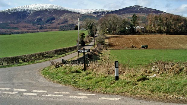
02 To get to the start
of this walk you turn off the A710 at the sign for Ardwall. Above is the
view which greets you when you do this. The dark hill on the right is
Knockendoch and Criffel is the snow covered hill on the left. The route
we are taking runs up the right shoulder (NE) of Criffel. The summit of
Criffel is 569 mts above sea level. Because of it's isolated position,
well separated from any hill of similar height, it presents views in all
directions a full 360 degrees.
To the east it overlooks the mouth of the River
Nith and to the Caerlaverock area beyond , famous for it's 13th
century castle, it's Wildfowl
and Wetlands Trust bird sanctuary on the merse and for the nearby
and outstanding Ruthwell
Cross dating from the 7th century - a major monument of international
importance in the history of Hibero-Saxon
art. To the south you look over the Solway
Firth to the Lake
District of England. West you look along the Galloway
coast and on a clear day you can see the Isle
of Man without any difficulty. To the north west are the Galloway
hills in the distance and to the north east the Moffat hills and Ettrick
hills.
Being so close to the town of Dumfries,
Criffel has iconic sentimental importance to it's inhabitants - the "Doonhamers".