Hill walk
routes to climb in SW Scotland - also coastal paths and National Scenic
Areas with maps, pictures and other useful information based on extensive
local knowledge
Around
Mulberry Harbour Remains Garlieston
Click on
the left side of the image below to go back to the previous page
or, on the right side of it to go to the next page.
or, on the right side of it to go to the next page.
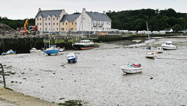
We were soon on our way again (around 1.30pm) heading round by the harbour as you can see in the picture below with the tide still well out. New flats are being built around the harbour and as far as I can see they are creating buildings that are quite in keeping with the site.
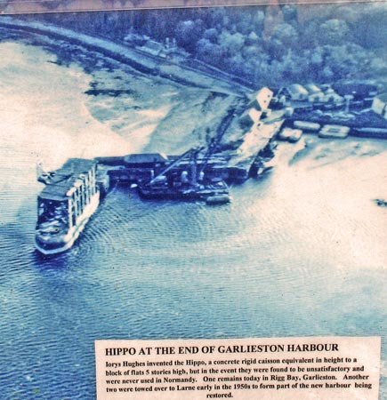
The second picture below shows the harbour from the air during the war years.
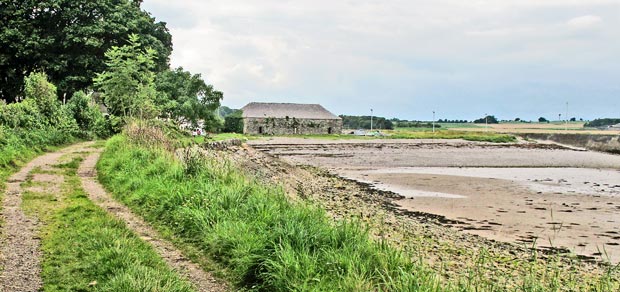
In the third picture below we are looking back towards the harbour area from the path that takes us to Rigg Bay and Cruggleton Castle. We had had plenty of rain in the weeks leading up to the point when we did this walk and there were plenty of very muddy places along the path as we went. We met several other people walking in this area, some with shorts on. I don't recommend shorts if you intend to go as far as Gruggleton Castle at this time of year because there are too many brambles and nettles trying to take over the path as you get near the castle.