Lowther Hill by Thirstane and Wether Hill
Map of whole Lowthers area - Site Homepage - Lowthers Home - Lowthers Page list
Lowther by Thirstane and Wether Hill Home
Click on the left side of the image to go back to the previous image and on the right side of the images to go to the next image.
View of the saddle at the top of the valley between Wether Hill and Steygail View of the saddle at the top of the valley between Wether Hill and Steygail View of the saddle at the top of the valley between Wether Hill and Steygail
26 Here is the saddle at the top of the wee valley you saw in picture 25 with a very steep ascent on to Steygail going up to the right - the elephant's forehead. We have never ascended that though we have come down it several times. You can well imagine how tricky that would be in snow conditions without crampons, and in fact Sandy and I have given up on the idea of going up there in just such conditions, deciding to come down this wee valley to the Enterkin Burn instead.
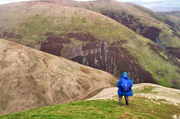
The descent continues much further and more steeply on the other side of that saddle, so if you started sliding you would have a long way to go as you can see in the picture below which was taken on 11th February 2002 from the top of Steygail ready to descend the elephant's forehead. That's Cold Moss opposite.
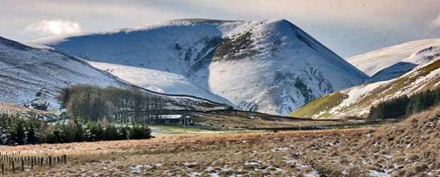
The third picture is borrowed out of the Rodger Law web gallery (page 27) from 4th March 2009 and gives you another view of this descent - this time as seen from Troloss at the top of the Dalveen Pass.
View down the steep descent off Steygail towards the saddle between Wether Hill and Steygail
View from Troloss of the steep descent off Steygail towards Wether Hill
Go to Page 25
   
Go to Page 27