Hill walk routes to climb in SW Scotland
- also coastal paths and National Scenic Areas with maps, pictures and
other useful information based on extensive local knowledge
Cairnsmore of Fleet by the Tourist
Route (2)
|
Hill walk routes to climb in SW Scotland
- also coastal paths and National Scenic Areas with maps, pictures and
other useful information based on extensive local knowledge
|
||
|
Cairnsmore of Fleet by the Tourist
Route (2)
|
||
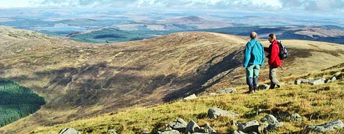
| Taking the circular route back down you would want to keep to the east side of the plateau on the top of Cairnsmore, since you have already seen the view west, and since the view east is quite impressive in it's own right. In the picture below we are looking north east from north end of the plateau down onto the top of the ridge of Meikle Mulltaggart which will lead you onto Cairnsmore when you come in from Murray's monument (along the ridge running out of the picture on the left). The dark triangular hill in the medium distance just right of centre is Cairnsmore of Dee - the lowest of the 3 Cairnsmore Hills at 493m, the other being Cairnsmore of Carspharin which is the highest of the three at 797m. Cairnsmore of Fleet reaches 711m. The water that you see near the left edge of the picture is Clatteringshaws Reservoir. | ||
|
||
|
||
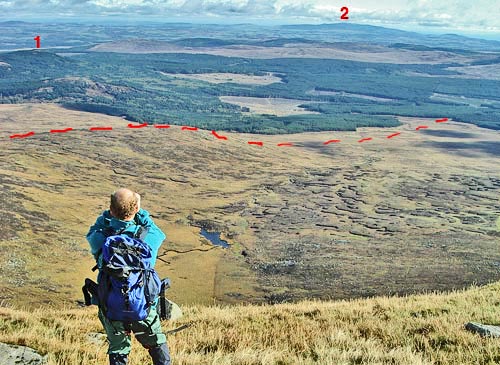
| In the picture above we are looking east from Clints of the Spout on the top of the plateau down over the nature reserve over 400ms below. The red dashes show the route back to Clints of Dromore if you should try that route onto Cairnsmore. 1 is Loch Grannoch and 2 is Criffel just south of Dumfries. | ||
|
||
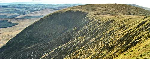
| The picture above is taken from the Knee of Cairnsmore looking due south to the Door of Cairnsmore. The plateau narrows here at the Nick of Clashneach and there is a little col before you head up to the cairn that you can see in the picture, from where you will descend in a SW direction. | ||
|
||
|
||
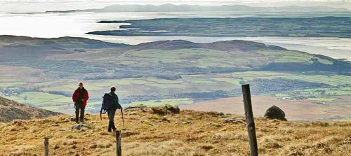
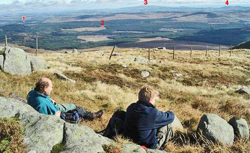
| The top picture above is taken as we descend into the Nick of Clashneach looking SW over the Machars of Wigtownshire out to the Isle of Man - which can be seen clearly stretched across the horizon from edge to edge of the picture. The second picture above shows where we had our "piece" break in the lee of the rocks and catching the sun with spectacular views to the south from the Nick - magic! 1 is Loch Grannoch, 2 is the old railway viaduct near the Clints of Dromore, 3 is Criffel and 4 is Screel (just south of Castle Douglas) | ||
|
||
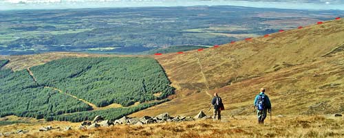
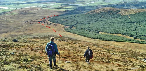
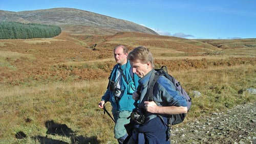
| As we begin to head SW down from the cairn at the top of Door of Cairnsmore you can see clearly where we made our ascent out of the trees earlier in the day (red dashes in the picture above). If you compare the picture above with the one below you can see where the 2 pictures overlap. The picture below shows the route taken past the trees. On the OS map you will see that there is a track running through to Knocktim; we join this track and follow it back to Cairnsmore House. The last picture shows the view back from that track up the route we have just descended. | ||
|
||
|
||