Hill walk routes to climb in SW Scotland
- also coastal paths and National Scenic Areas with maps, pictures and
other useful information based on extensive local knowledge
Around St Mary's Loch
Click on the left side of
the image below to go back to the previous page
or, on the right side of it to go to the next page.
or, on the right side of it to go to the next page.
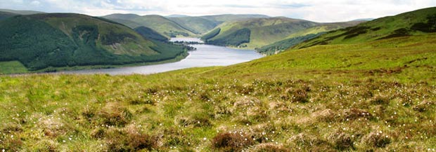
Click here for a couple of short extracts from this booklet; one dealing with this narrow stretch of land between the two lochs and the second giving a fine story about Sunday worship and a sheep dog. The far end of Loch of the Lowes (the end nearest to Moffat) is fed by the Little Yarrow burn. This water then runs through both these lochs and emerges from the eastern end of St Mary's Loch (where we will cross it) as the River Yarrow - a name that resonates with the romantic history of the Borders - of Walter Scott's tales and the Border Ballads. Eastward beyond St Mary's is the Ettrick Forrest once the hunting ground of the Scottish Kings.
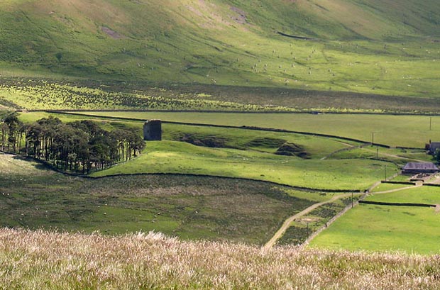
Below we are using a bit of zoom to look back to the tower from Kirkstead Hill. You can see the track of the Southern Upland Way running up the east side of the Dryhope Burn beyond the tower. You can also see how you have to cut diagonally across the field from the tower to find the gate which takes you onto the vehicle track that we went along to Old Kirkstead.